


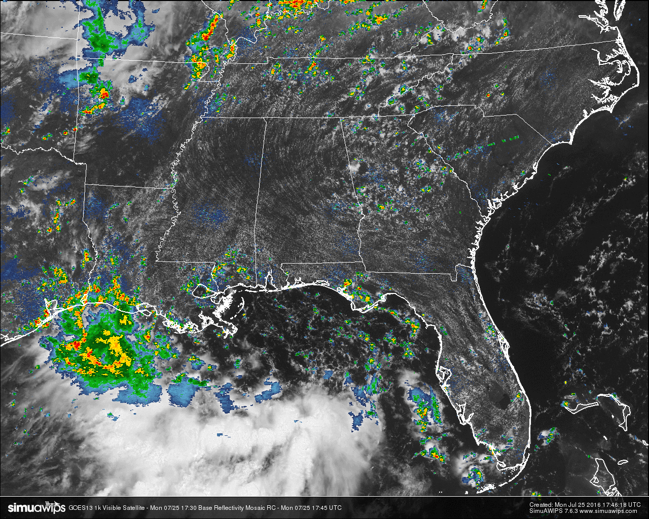
Skies across Central Alabama are mostly clear with just a few cumulus clouds floating around. Not much in the way of rain on the radar at this hour in the area. There are a few very isolated showers that have popped up around the Alexander City and Auburn areas, and they are mainly moving to the west. Otherwise, high and dry for everyone else.
TEMPERATURES AT THIS HOUR: Heat is building as we start to reach the daytime maximum temperatures for the day across the area. Here is a list of temperature observations from across the area:
Birmingham 91
Tuscaloosa 89
Gadsden 91
Anniston 90
Cullman 90
Hamilton 89
Clanton 91
Alexander City 93
Montgomery 91
WHAT TO EXPECT FOR TODAY: Looks like another typical late July day here in Central Alabama. Partly to mostly sunny skies across the area with the risk of scattered afternoon showers and thunderstorms. Afternoon highs will be in the low to mid 90s, with the heat index in the upper 90s. Best chance of rain will be from 12PM to 9PM, and will probably be east of I-65 (but one could pop up anywhere). Odds of any one spot getting rain will be around 1 in 4.
CODE GREEN AIR QUALITY: The Air Quality Index for the Birmingham Metropolitan Area will be in the “Code Green” for ozone. No actions needed for today.
TODAY’S CLIMATOLOGY FOR BIRMINGHAM: The normal high for July 25th is 91, while the normal low is 70. The record high for today was set back in 1952 at 106. The record low was set back in 1911 at 60.
TUESDAY’S OUTLOOK: The “Carbon Copy Forecast” can be used for this weekend. Partly to mostly sunny skies with a risk of scattered afternoon and evening showers and thunderstorms. Afternoon highs will be in the low to mid 90s, with the heat index near 100. The odds of any one spot getting rain each day is 1 in 3. Overnight lows will be in the 70s.
HEADED TO THE BEACH: It will be the usual summer setup this week on the coast from Gulf Shores over to Panama City Beach. About 7 to 9 hours of sunshine daily, but a passing thunderstorm is likely from time to time. Highs on the immediate coast 87-90, with mid 90s inland. The sea water temperature early this morning at the Dauphin Island Sea Lab is 86 degrees. See a very detailed Gulf Coast forecast here.
THE TROPICS: The Atlantic basin remains very quiet, and tropical storm formation is not expected through the next five days.
ON THIS DAY IN 1956: Off the coast of Massachusetts, near Nantucket Lightship, the Swedish-American liner called the Stockholm, rammed the Andrea Doria in dense fog. 52 people perished in the accident.
WEATHERBRAINS: This is the show all about weather featuring many familiar voices, including our meteorologists at ABC 33/40. You can listen anytime on the web, or on iTunes. You can find it here.
ADVERTISE WITH US: Deliver your message to a highly engaged audience by advertising on the AlabamaWX.com website. The site enjoyed 10.2 MILLION pageviews in the past 12 months. Don’t miss out! We can customize a creative, flexible and affordable package that will suit your organization’s needs. Contact Bill Murray at (205) 687-0782.



