


Greetings from the beautiful Alabama Gulf Coast… we are right under our SKYCAM at the Phoenix All-Suites, at the public beach (by the Hangout), and so far no sign of any oil, and no oil smell here. See some images below taken within the last few minutes…
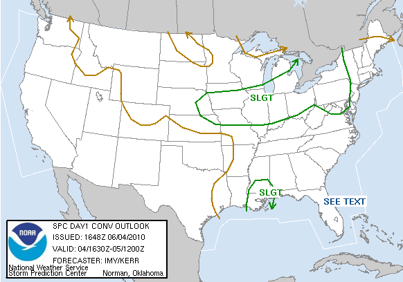
NORTH-CENTRAL ALABAMA: Showers and storms continue to increase in a broad area from Jasper to Birmingham to Talladega and Roanoke. These showers are moving northeast, and will produce locally heavy rain and some lightning as they move through. The upper low to the west continues to drift in our direction, and showers and storms are likely for the rest of the afternoon and into early tonight. SPC has defined a slight risk of severe weather in the vicinity of the upper low, over South Mississippi, Southwest Alabama, and Southeast Louisiana…
WEEKEND OUTLOOK: Lots of model madness concerning the coverage of showers and storms over the weekend; the GFS looks relatively dry, while the NAM is wet. We will probably roll with a persistence forecast, and mention a risk of scattered, mostly afternoon and evening showers and storms tomorrow and Sunday, but not as numerous as today.
Will post updates this afternoon as needed… going to spend a little time enjoying Alabama’s beautiful Gulf Coast here at the lunch hour…



