


From this Cuban radar, you can see the outer rainband of Ike beginning to impact Cuba and the eyewall over Great Inagua island in the Bahamas…
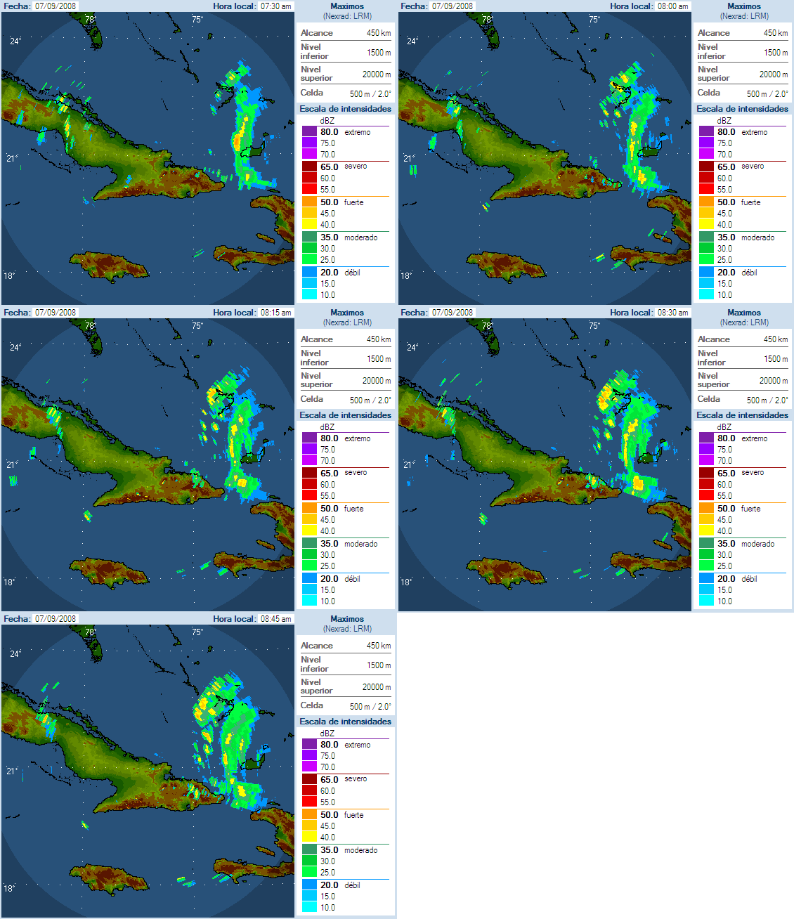
…The Turks and Caicos have taken a direct hit from Ike. The Associated Press reports that 80 percent of the homes on Grand Turk island have been damaged. No reports of deaths or injuries.
…The eyewall is moving over Great Inagua Island.
…Drier air is visible on the water vapor satellite imagery this morning wrapping around the west and south side of Ike….this could lead to weakening of the storm even before it starts interacting with Cuba.
…Recon mission 7 into Ike is complete. The plane departed the storm after a vortex fix just after 6 a.m. CDT. Mission 6 was a high altitude dropsonde mission to sample the environment around the hurricane.
…Four missions are planned for later today, two for low level fixes and two for high altitude dropsonde deployments. The first flight is due into the storm by early afternoon. It will depart around 10 a.m. this morning.
…Things are looking better for the Keys. Of its expected course, Ike will traverse much of the island of Cuba…weakening it considerably. And the southerly track should keep it far enough south to prevent significant impact. But the watch word in the Keys is better safe than sorry and evacuations are going well. Tropical storm winds will reach the Lower and Middle Keys after midnight Monday night and continue for much of Tuesday. Strong tropical storm force winds are not likely and hurricane conditions even less likely. The NWS estimates the probability of hurricane force winds in the Keys at less than 20%.
…we will be watching all of the 12z models with interest. The initial data was supplemented with the data from the high altitude recon mission earlier this morning, so agreement and accurancy should be improved…
New advisory and forecast package will be out at 10 a.m. We will keep you informaed with the latest information on Ike throughout the week ahead…



