


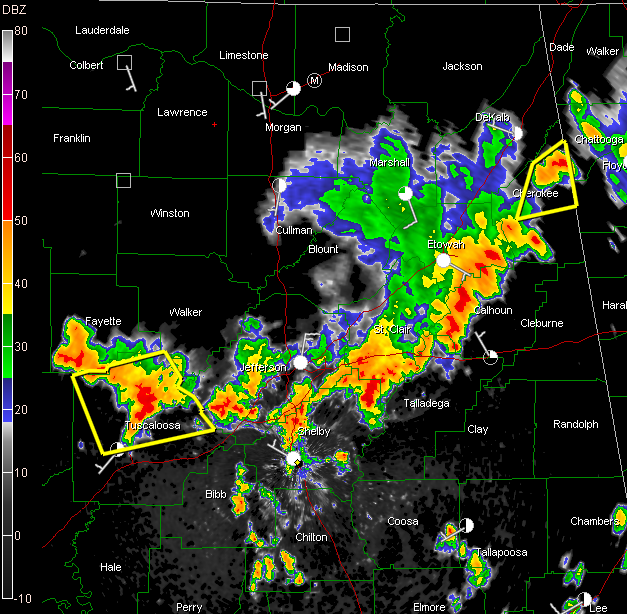
The line of storms has weakened just a tad this afternoon as it moves southeastward.
From Jefferson through northern Shelby, Talladega, St. Clair into Calhoun Counties has grown just a bit tamer.
A severe thunderstorm warning continues for Cherokee county and for Tuscaloosa Counties.
New Warning just issued: Severe Thunderstorm Warning for Fayette, Pickens, Tuscaloosa [AL] till 2:00 PM CDT
In Tuscaloosa county, the storms are strongest from Bankhead Lake down to Holt Lake on the Warrior River over to Kellerman. They will be approaching Brookwood.
Storms are growing now over eastern Bibb County east of Centreville down into southwestern Chilton County. They will move toward Autauga County.
Intense and growing storm between Pelham and Hoover over to near Oak Mountain State Park.
Lots of intense lightning, very heavy rain and downburst winds with these storms.
Be in substantial shelter as they approach.
LATE REPORT FROM ST. CLAIR COUNTY
Argo [St. Clair Co, AL] public reports LIGHTNING at 12:40 PM CDT — lightning strike caused downed tree and powerline on quail ridge rd.



