


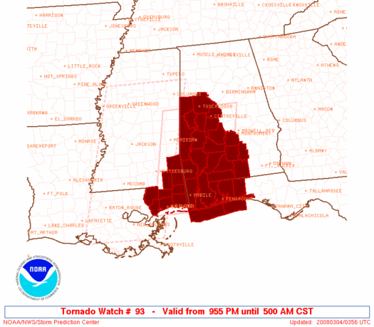
The Storm Prediction Center has issued a new tornado watch for West Central and Southwest Alabama.
It goes until 5 a.m. CST.
It is generally south of Tuscaloosa and Clanton…it includes Bibb, Dallas, Greene, Hale, Lowndes, Marengo, Perry, Pickens, Sumter and Tuscaloosa Counties in Central Alabama.
A powerful squall line, known as a QLCS, or Quasi-Linear Convective System is moving east northeast across eastern Mississippi tonight.
A strengthening low pressure system over Northwest Mississippi is drawing unstable air northward into Alabama tonight. A powerful upper level system with very strong winds aloft is enhancing the thunderstorm intensities.
This system will produce damaging winds measuring as high as 70-100 mph or a wide area. There may also be significant tornadoes embedded in the line.
North of this powerful squall line, damaging winds will be the main threat, although isolated tornadoes can’t be ruled out with stronger storms overnight. There will be lots of heavy rain and lightning.
In addition, there will be strong winds outside of thunderstorms. Winds gusted to 60 mph recently at Meridian. These strong winds can bring down large limbs that can crush cars, houses, and mobile homes. They can also uproot trees.
Pay close attention to the weather overnight and sleep somewhere safe. Mobile homes should be abandoned before intense storms approach. Keep that weatheradio on if you go to bed.



