


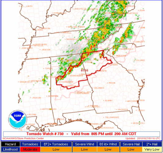
A new tornado watch has just been issued for Central and Northeast Alabama that goes until 2 a.m.
Central Alabama counties include: Bibb, Blount, Calhoun, Cherokee, Chilton, Clay, Cleburne, Coosa, Etowah, Jefferson, Randolph, Shelby, St. Clair, Talladega and Tuscaloosa.
Showers and thunderstorms will continue for the next several hours over North and Central Alabama. The area will only slowly sag southeastward and may even stall out. Heavy rain could be a threat overnight along with the potential for isolated embedded supercells. Keep an ear to the weather overnight just in case.
Here is a look at the radar.
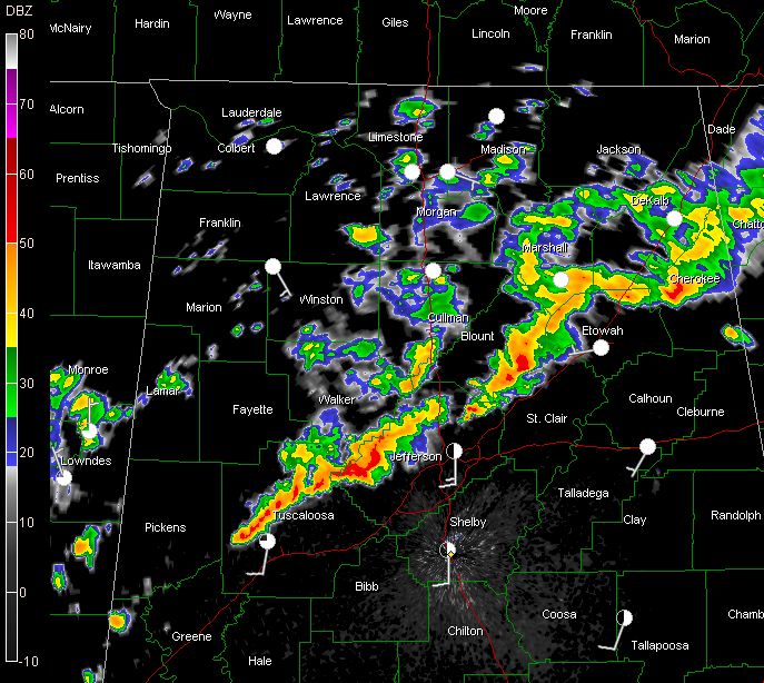
Strong storms south of Oneonta have prompted a severe thunderstorm warning for Blount, Etowah and St. Clair Counties.
Rain and heavy storms are about to move into the Birmingham area right now…but they do not have an appearance that would lead you to believe they would become severe at this time.



