


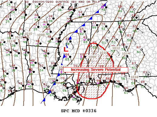
The Storm Prediction Center says that a new tornado watch will be likley generally south of US-82 in Southwest Alabama from about Tuscaloosa down to Montgomery by 10 p.m.
This follows the trend in my last post about increasing instability southeast of the surface low in Mississippi.
Wind fields will continue to increase overnight, enhancing the severe weather threat over Southwest and South Central Alabama.
For the rest of us, heavy rain, lightning and the possibility of some damaging winds overnight. Can’t rule out isolated tornadoes.
Stay close to a reliable source of weather information through the night.



