


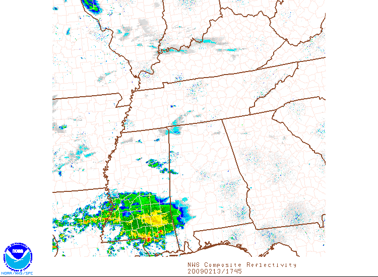
Here is a noon look at Alabama’s weather.
Clouds are increasing across the area as our next weather maker gets organized to our southwest. On the weather maps, we see a surface low over southeastern Kansas. A warm front is moving into Louisiana from the Gulf of Mexico.
A large area of showers and elevated thunderstorms continue across Louisiana and Southwest Mississippi. Quite a bit of lightning over southern Mississippi, south of Columbia and Hattiesburg up to Laurel. Heavier thunderstorms will reach Hattiesburg within the hour. It will be a wet ride along I-59 south of Meridian.
A few lighter showers were over eastern Mississippi, west and southwest of Columbus. They were beginning to edge into Pickens County, Alabama. The air over Alabama is dry, with dewpoints still in the 30s. It may just a short while for the precipitation to reach the ground.
Temperatures are in the 60s across Central Alabama, warmer in the east, where there has been more sunshine. Thicker clouds in the west have slowed the thermometer’s rise a bit.
Rain will spread into Southwest and West Alabama later this afternoon and across the state tonight. There will be a little thunder mixed in. No strong storms are expected in Central Alabama, although there could be severe weather along the Gulf Coast.
Temperatures will drop into the 50s tonight.
Rain will end during the early morning hours with some peeks of sunshine tomorrow afternoon. Rain could edge back into Central sections Saturday night and early Sunday as another disturbance passes. South Alabama will get some healthy rains.
The next weather maker will come late Tuesday night with rain and storms. The threat of severe weather appears very low.
Uncertainty in next weekend’s outlook. The latest run of the GFS keeps us dry and cool. An earlier run brought in rain late Friday. We will have to wait and see.
Thanks to JB for swapping shifts with me today so that I can be at Samford tonight for Step Sing.



