


We now officially have Tropical Storm Debby in the Gulf of Mexico.
Tropical storm watches have been posted along the Gulf Coast from the mouth of the Pearl River (Louisiana/Mississippi border) to Morgan City, including New Orleans.
DEBBY DETAILS
As of 4 p.m. CDT…
POSITION
Latitude 26.2N
Longitude 87.6W
…220 miles south southeast of the Mouth of the Mississippi River
…310 miles south of Mobile
MOVEMENT
North 6 mph
INTENSITY
Max winds 50 mph
Central Pressure 1001 millibars/29.56 inches
FORECAST TRACK
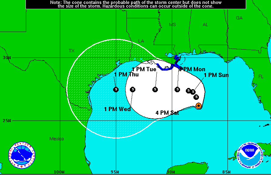
The official cone is for a track that follows the westerly track predicted by the European model and takes Debby toward the Middle Texas coast. That is not poured in concrete, so all interests along the Gulf Coast need to stay informed on Debby.
FORECAST INTENSITY
The official forecast keeps Debby just below hurricane intensity for the next five days.
IMPACT ON THE NORTHERN GULF COAST
Lots of people have questions about their plans regarding beach trips in the coming week. Already, tides are running higher than normal along the northern Gulf Coast because of the persistent east southeasterly low level flow around the low. Waves will be running 5 to 7 feet along the coast, causing erosion. Coastal flooding will be a problem along the northern Gulf Coast with tides averaging some two feet above normal through Monday evening. This will cause inundation of the western end of Dauphin Island, the Mobile Causeway and the road to Fort Pickens in Pensacola.
Rip currents will be a MAJOR problem and visitors are urged to stay OUT of the water. There will be scattered showers and storms along the coast on Sunday, but it looks like the heaviest rain may stay offshore. Coastal areas may see up to an inch, but the amounts will drop off quickly as you move inland. Winds will increase to 10-20 mph tomorrow with occasional higher gusts.
ALL INTERESTS along the Gulf Coast should remain up to date with the latest weather information on Tropical Storm Debby.
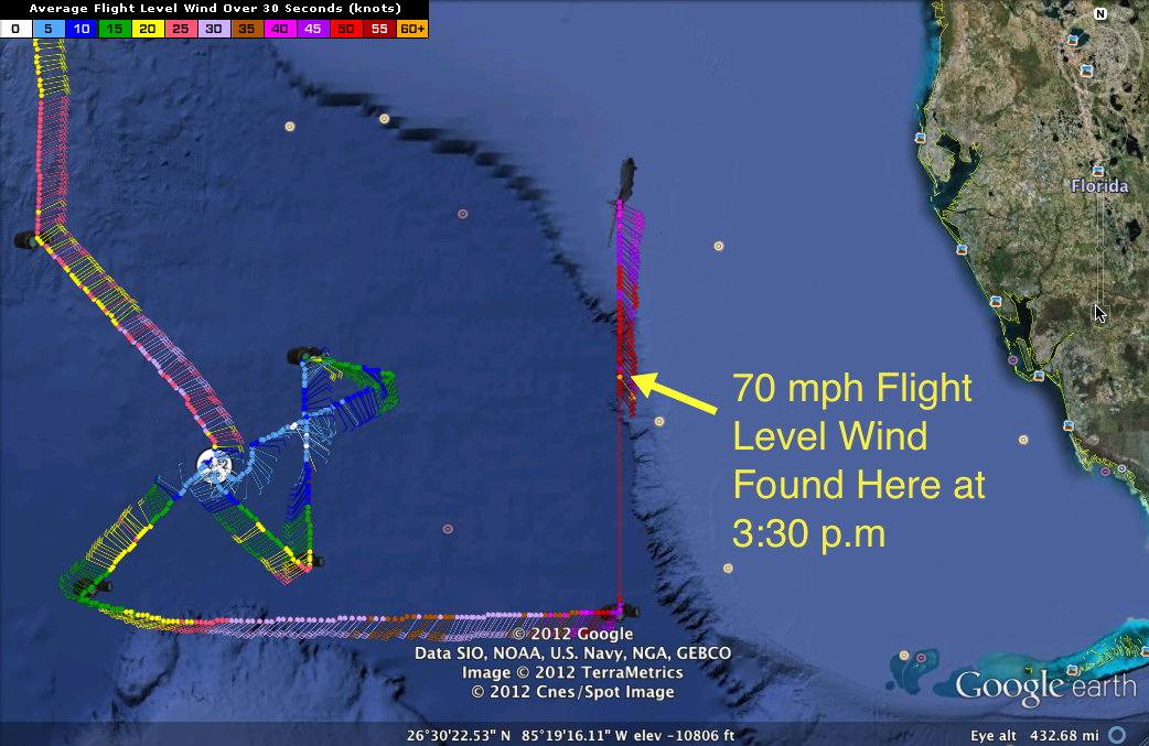
The Air Force Reconnaissance flight found a 70 mph flight level wind at 26.48N, 85.0W at 3:30 p.m.. This is east of the center, about 150 nautical miles, or about 175 miles west of Captiva on the Florida West Coast. The Stepped Frequency Microwave Radiometer estimated the surface wind at 45 mph. The wind was southeasterly. It is in a strong feeder band found there.



