


**No afternoon Weather Xtreme video today; I am in Gadsden where we are programming NOAA Weather Radio receivers at Academy Sports. If you need help… come see us. We will be here until 6:30 p.m.**
ONE MORE: Tomorrow will be another mostly sunny, warm day for Alabama with a high in the mid to upper 80s, but showers and storms will return Friday afternoon. Here is output from the high resolution NAM model valid Friday at 4p CT….
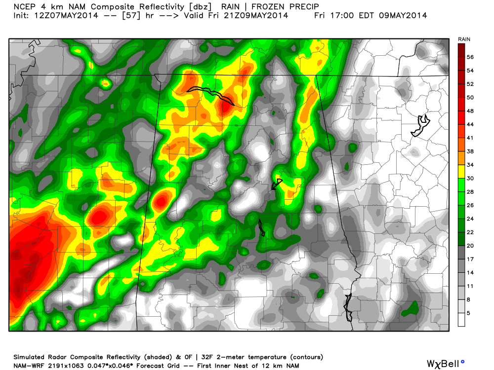
Severe weather is not expected as the main dynamic support will be far north of Alabama, but some thunder is certainly possible Friday afternoon through Friday night.
THE ALABAMA WEEKEND: A few lingering showers are possible Saturday, but it sure won’t rain all day, and the sun could break out at times. And, Sunday looks generally dry with a mix of sun and clouds and only a small risk of a shower. The high Saturday will be in the low 80s, followed by mid 80s Sunday.
NEXT WEEK: The chance of a shower Monday will remain rather small, but showers and storms increase Tuesday ahead of a cold front. Then, drier and and cooler air rolls into the state for Wednesday and Thursday. For now the event Tuesday doesn’t look like a severe weather threat.
AT THE BEACH: Mostly sunny tomorrow, but a few showers and storms are likely Friday afternoon and Friday night. Then, just a few scattered showers Saturday and Sunday with about 3 to 5 hours of sunshine both days over the weekend from Panama City over to Gulf Shores. Highs on the immediate coast will be in the upper 70s, with 80s inland.
WEATHER BRAINS: Don’t forget you can listen to our weekly 90 minute netcast anytime on the web, or on iTunes. This is the show all about weather featuring many familiar voices, including our meteorologists here at ABC 33/40.
CONNECT: You can find me on all of the major social networks…
Facebook
Twitter
Google Plus
Instagram
Look for the next Weather Xtreme video here by 7:00 a.m. tomorrow…



