


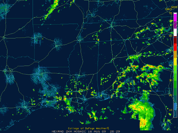
The outer spiral band of Tropical Storm Claudette was over South and Southeast Alabama this afternoon. It extended from Evergreen and Greenville to east of Montgomery to near Lafayette in Chambers County.
It was rotating northwestward this afternoon.
A heavy shower was near Prattville.
Other showers were developing over northern Bibb, western Shelby and extending into eastern Tuscaloosa and southwestern Jefferson Counties. One of them was in the Fairfield/Midfield area of western Birmingham.
Scattered showers and storms will continue to develop this afternoon over Central Alabama. The spiral band will continue to move northwestward.
As clouds broke up during the early afternoon, temperatures warmed into the middle and upper 80s. I had scaled back those temperature forecasts at noon by some 5 degrees thinking the clouds might continue to hold the mercury back.
The humidity levels are high with an increasingly tropical airmass over the state. That will continue as the moisture from Tropical Storm Claudette continues to push into Alabama tonight.
It has gotten a little breezy this afternoon with winds averaging 10 mph and occasionally gusting to over 15 mph.
Expect storms to increase over South Alabama and move up into Central Alabama overnight and on Monday. The center of Claudette should move to near Demopolis by morning and on northwestward through West Alabama during the day on Monday. There could be a few tornadoes tomorrow east of the track. They would be small, quick spin ups, but be ready to take action if watches and warnings are required tomorrow.
Rainfall amounts tomorrow should average between one and two inches across Central Alabama.
More on Claudette including the latest from the NHC in just a few minutes.



