…TORNADO WARNING PICKENS COUNTY…SEE BELOW FOR DETAILS…
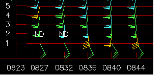
Above is the VAD wind profile with height (thousand ft) at NWS radar. Notice winds veer from SE at surface to SSW at 3,000 ft., and increase to 60 knots (70 mph) at 4,000 ft.). The models may have underestimated the wind shear. This direction and speed change with height is causing helicity over 700 m2/s2 in central Alabama.
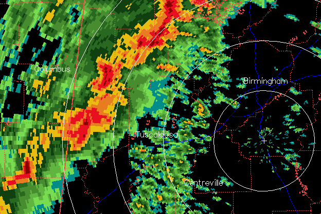
The main event is now entering W AL. Strong indications of tornado in Pickens. The storm in Fayette county (that caused a tornsado in Starkville, MS earlier) has weakened as it got into the more stable air farther NE.
There is still a weak frontal boundary across central AL that may be enhancing the rotation in the Pickens storm. The dewpoint at Demopolis is 63, also a little higher than models indicated, and with winds just off the ground at 50 mph, that air may make it to TCL, and possibly BHM, by the time the storms arrive. It will be a question of timing…does the humid, more unstable air get in place ahead of the storms fast enough to keep them strong, or do they outrun the moist air and weaken? I think TCL south and west definitely needs to worry, and BHM metro (Jeff, Shelby, Walker, Bibb, St. Clair at least) need to be ready for the possibility of a tornado. The extreme shear we are seeing tonight can actually cause storms to stay stronger, not just rotate more.
Even if the storms weaken some and tornadoes are not a problem farther east, any storm can bring the very strong winds just off the surface down to the ground, and 60 mph winds can cause a lot of damage. Heavy rainfall is also a problem here. Stay alert.