


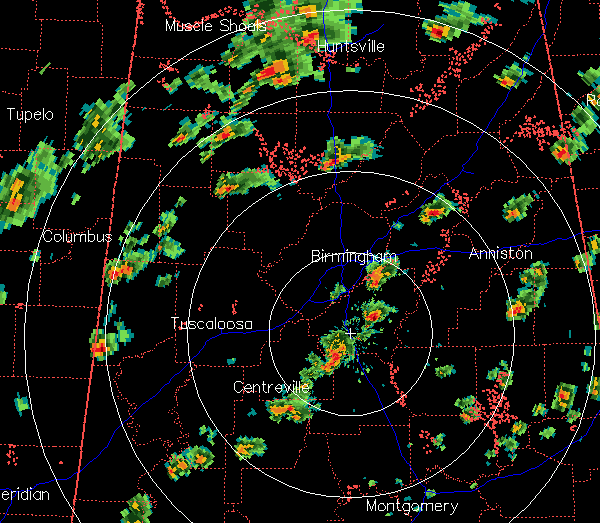
Storms have really ramped up over central Alabama in the past 30 minutes, with multiple tornado warnings in effect. These will likely continue for the next couple of hours or so, since wind shear is high over north and central AL. The wind shear is weakening with time, so hopefully we’ll be out of the rotating storms by 6 pm.
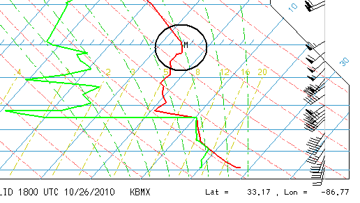
The storms today are quite small on radar, almost like the mini-supercells you see during a landfalling hurricane. This could be due to another temperature inversion aloft. An extra balloon was released at 18Z (1 pm) at NWS BMX, and it shows very unstable air now at low levels, but a capping inversion near 500 mb. So, the storms are rather shallow and small. This does NOT keep them from producing tornadoes, it just should prevent this from becoming a major tornado outbreak (in number or in intensity of tornadoes).
Nevertheless, even small tornadoes can produce life-threatening damage, and when a tornado warning is issued, go to your safe place immediately! It’s not small if it hits your house.



