


Here is a peek at the low level storm relative helicity in the lowest 1 kilometer of the atmosphere across the Deep South (veering of the wind with altitude)
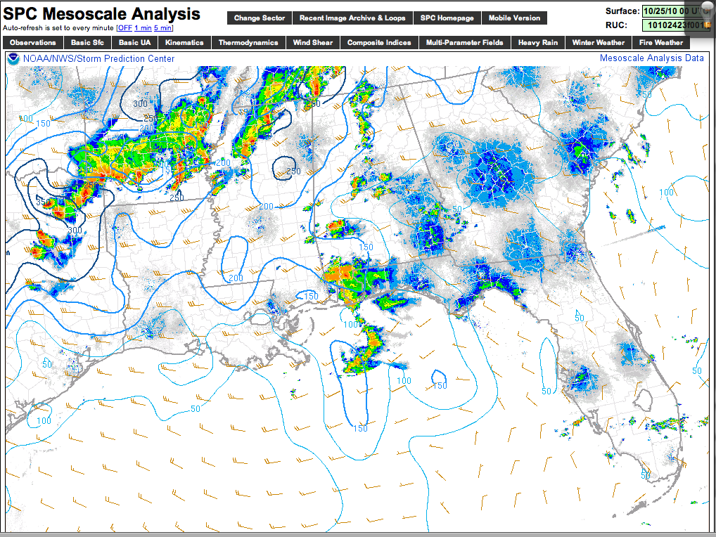
You can see values are highest at this hour over North Mississippi, Northwest Alabama, and Middle Tennessee. There is another area of higher low level helicity over the Ark-La-Tex region, where a number of tornadoes have been reported.
Bottom line is that the storm complex moving into the Birmingham metro will pose mainly a hail threat, with only minimal tornado potential. NWS Birmingham maintains a severe thunderstorm warning for parts of Bibb, Shelby, and Jefferson Counties.
Overnight storms will need to be monitored…



