


Rain and storms across northern Mississippi are moving eastward and will overspread North and North Central Alabama this morning.
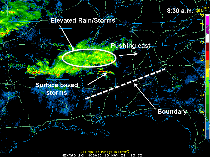
The cold front that moved through Central Alabama overnight is located somewhere around a line from Livingston to Prattville to Lafayette. Widespread rain and embedded storms are expected north of this boundary today.
Over North Alabama, the storms will be elevated, meaning they are drawing their instability from about 5,000 feet above the surface because the surface layer is fairly stable.
In the Tuscaloosa, Birmingham and Anniston areas over to Columbus, Mississippi, dewpoint are high enough for the storms to be surface based. This means there is something of a chance they could be strong to severe. These stronger storms will enter Pickens and Lamar Counties within the hour.
Severe weather is more likely south of the boundary over South Alabama.
Heavy rain will be a threat over North Central Alabama. A flash flood watch continues for Blount, Calhoun, Cherokee, Clay, Cleburne, Etowah, Fayette, Jefferson, Lamar, Marion, Pickens, Randolph, Shelby, St. Clair, Talladega, Tuscaloosa, Walker and Winston Counties through late tonight.



