


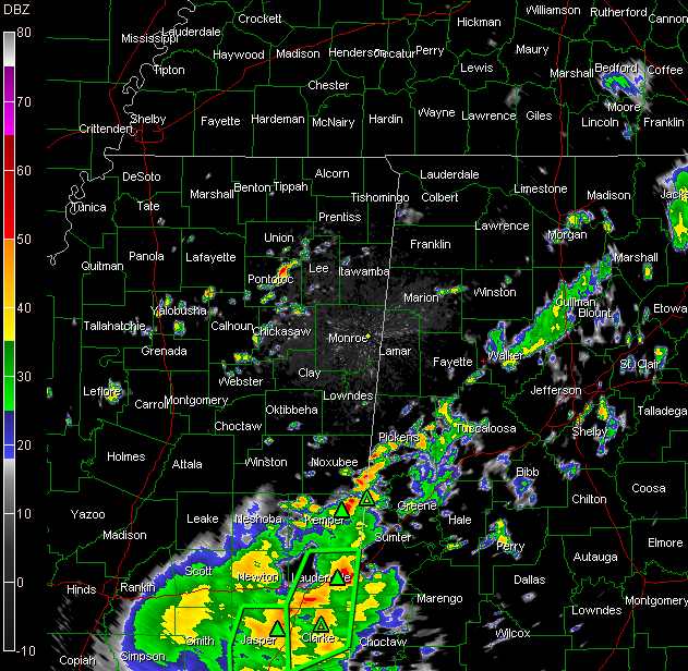
A weak surface low has formed near the Missouri Bootheel. An upper trough was moving across South Alabama, while a stronger trough was moving across Western Mississippi.
Showers were increasing in about a 50 mile wide band generally centered on I-59 from Pickens and Greene counties northeastward through the Birmingham metro into Marshall, Jackson and DeKalb Counties.
Very heavy rain was over East Central Mississippi extending southwestward from about Meridian. Flash flood warnings were in effect from Jones and Jasper Counties into Lauderdale and Clarke Counties.
One hour rainfall rates were over an inch with isolated two inch per hour amounts around Meridian.
The rain and storms will continue to spread northeast through the afternoon then start moving eastward as the trough progresses eastward.
Most areas should pick up between one half and three quarters of an inch of rain although we will have to watch for the potential for heavier amounts.



