


Showers and thunderstorms still in progress at 12:20 am CDT in the Birmingham area, with the heaviest rain from near Huffman to Tarrant, and also near Graysville. Rainfall rates in past hour have exceeded 0.25″ inches/15 minutes in some spots. North Alabama Lightning Mapping Array (operated by NASA) still indicates lightning, most of it in-cloud. Thunder shook the house here in Trussville just a few minutes ago!
Storms have been persistent this evening in central Alabama. Below is a radar animation from 800 pm to midnight. One area of storms came through BHM between 9 am 10 pm, and another one moved in to northern suburbs after 11 pm.
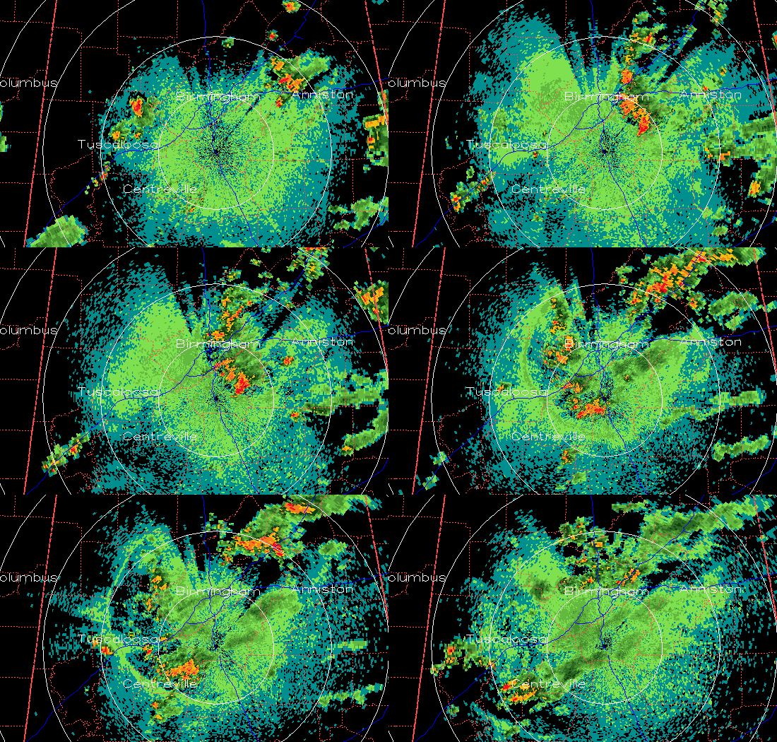
Some cool stuff on this radar loop…note the thin band, representing the cool outflow, spreading out to the west from the storms in the BHM area. This band really starts moving west of the Warrior River, and may represent an atmospheric bore, a type of wave formed in the stable air near the ground at night when storm outflow disturbs it, a little like throwing a pebble in a still lake.
Also notice the area to the north of the radar where the ground clutter is thinner. This is due to beam blocking by mountains, and is something that can affect radar measurements in storms. We are working on this at UAH (the BREAM model). More on that later.



