


An all new edition of the ABC 33/40 Weather Xtreme video is available in the player on the right sidebar of the blog. You can subscribe to the Weather Xtreme video on iTunes by clicking here.
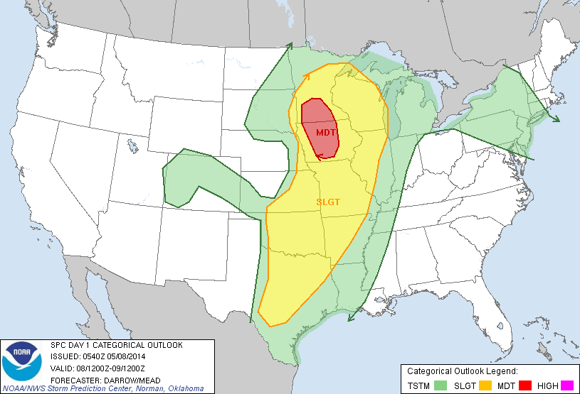
ONE MORE DRY DAY: No real change in our weather today; a good supply of sunshine with a high in the mid to upper 80s. The active weather remains west of Alabama, where severe storms are possible this afternoon and tonight from Texas to the western Great Lakes.
WET TOMORROW: Showers and storms will move into our state tomorrow afternoon, continuing tomorrow night. The main upper dynamics will weaken and pass well north of our state, so no severe weather is expected, but there will be some thunder at times. The main window for rain for North/Central Alabama will come from about 2:00 p.m. through 12:00 midnight, although it won’t rain during the entire time. I doubt if we get out of the 70s tomorrow with clouds and rain.
THE ALABAMA WEEKEND: The weather won’t be as wet Saturday… just a few widely scattered showers during the day, and the sun should peek out at times. Then, Sunday looks generally dry with only a very small risk of any one spot seeing a shower with a mix of sun and clouds. The high Saturday will be close to 80, with low to mid 80s Sunday.
NEXT WEEK: Just a slight risk of a shower Monday, then a band of showers and storms will pass through late Tuesday and Tuesday night ahead of a front; for now we don’t expect any severe weather. Then, cooler and drier air arrives Wednesday and Thursday. Looks like we are headed for the 40s early Thursday morning… not many more cool mornings left like that before the long, hot summer gets here. See the Weather Xtreme video for the maps, graphics, and details.
AT THE BEACH: Dry and warm today with a good supply of sunshine, but showers and storms are likely tomorrow and Saturday with only a limited amount of sun from Panama City over to Gulf Shores. Showers become more widely spaced Sunday. Highs on the immediate coast will be in the upper 70s, with 80s inland. A flash flood watch is in effect for Gulf Shores and Pensacola tomorrow through Sunday. Sea water temperatures are mostly in the mid 70s.
WEATHER BRAINS: Don’t forget you can listen to our weekly 90 minute netcast anytime on the web, or on iTunes. This is the show all about weather featuring many familiar voices, including our meteorologists here at ABC 33/40.
CONNECT: You can find me on all of the major social networks…
Facebook
Twitter
Google Plus
Instagram
I have a weather program today at Ohatchee Elementary School in Calhoun County… look for the next Weather Xtreme video here by 4:00 or so this afternoon. Enjoy the day!



