


A frontal system lying along the border between Tennessee and Alabama/Mississippi triggered late evening storms over Northeast Mississippi prompted late severe thunderstorm warnings around Tupelo, then weakened.
But they expanded greatly in coverage through the overnight hours as they took advantage of the squeeze between a weak surface low over southern Arkansas and big high pressure east of Florida. They bubbled up and then fed on leftover heat and moisture in their march toward the Gulf.
The eastern flank of these storms made it into western Alabama about 1:30 and spread increasing storms down the western counties of the state. Folks in
Marion, Winston, Walker, Lamar, Fayette, Tuscaloosa, Pickens and even Greene got a little early Saturday shake, rattle and roll, but nothing was severe.
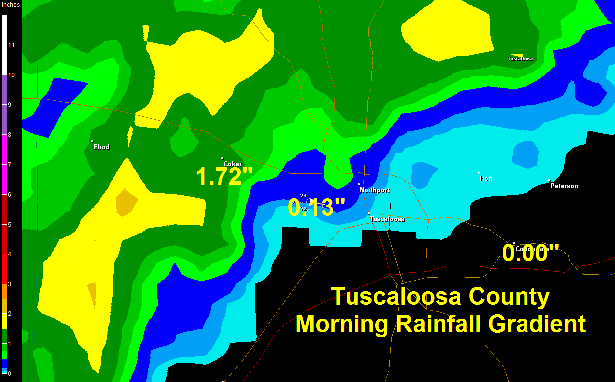
Radar estimates indicated that parts of Pickens, Lamar and southern Marion Counties may have gotten two plus inches of rain. A larger area got between one and two inches. The rainfall quickly died as it approached I-59.
The Tuscaloosa Airport picked up only 0.13 inches. Meanwhile, Ronald Hughes in Coker got 1.72 inches! He is just five miles from the airport! Most of Ron’s rain fell in 45 minutes.
Poor Wallace Williams in Cottondale didn’t get a drop. Not a drop fell on most of McFarland or Skyland either.
NORTHEAST RAINFALL: Other storms formed this morning over Northeast Alabama. Vic Bell at Black Creek in northern Etowah County reports another 2 inches to go with the six he has already picked up this month. He would be happy to share with anyone who needs rain.



