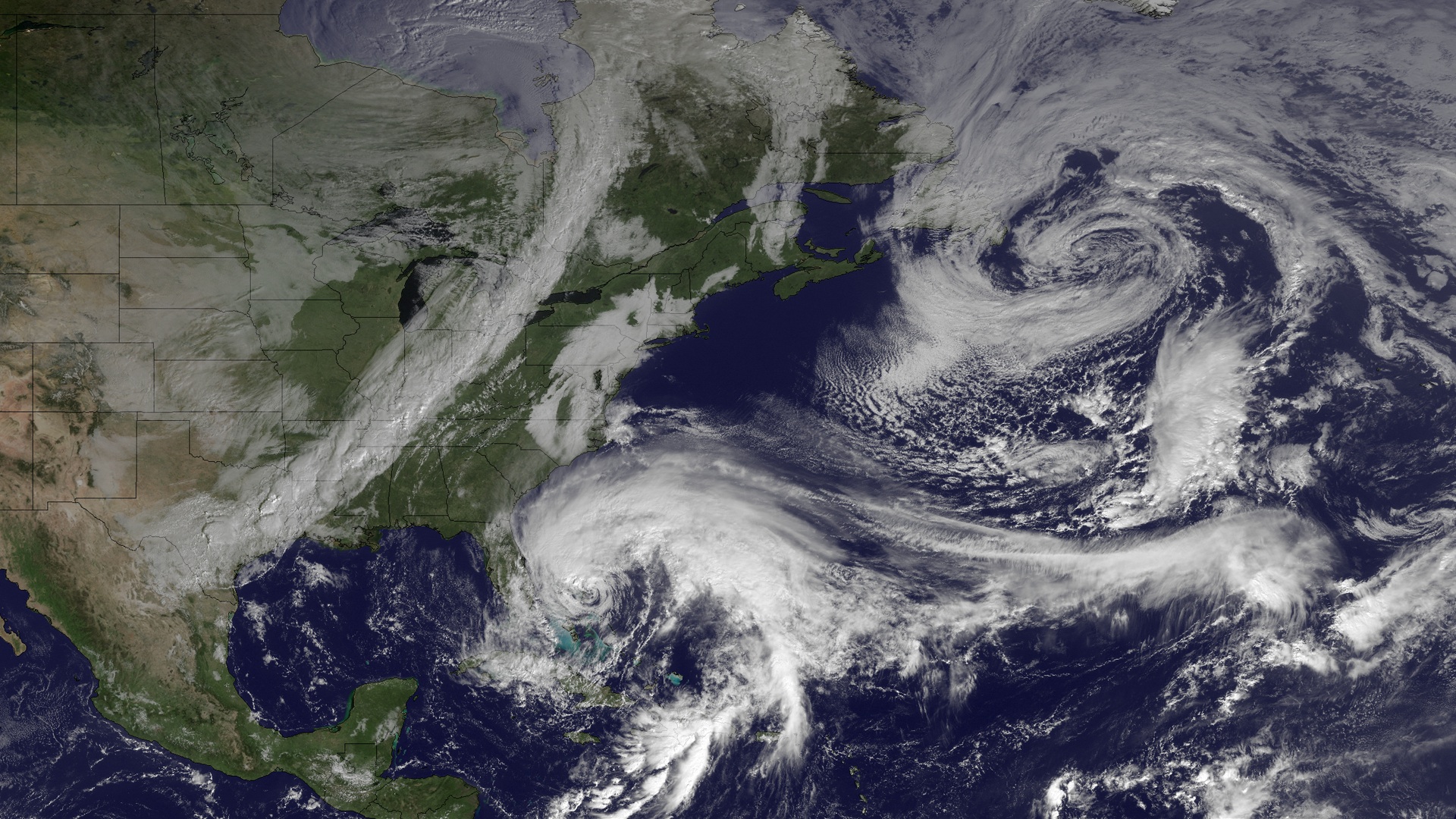
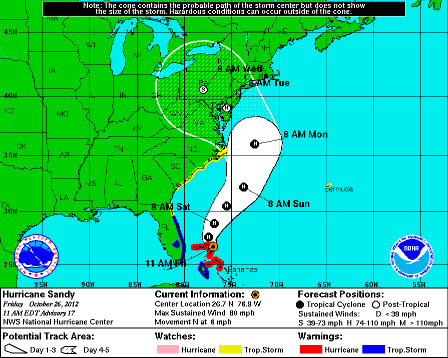
Pretty remarkable satellite view of the players on the field coming together for a potentially historic East Coast storm early next week.


Published on: October 26, 2012 at 12:09 PM
Pretty remarkable satellite view of the players on the field coming together for a potentially historic East Coast storm early next week.

 October 10, 2026 at 6:57 AM
Hurricane Isaias made landfall near Destin, Florida, last night at 8:30 p.m. as a Category 2 Hurricane. It is now a Post-Tropical Cyclone with its rainbands impacting the northern half of the state and much of Georgia this morning. Power outages statewide have reached 319,000 as of about 6 a.m. this morning. As we head into the day today, south Alabama will be mostly dry today, with just a shower or two possible. The northern half of the state will continue to see wind and rain throughout the day today, picking up an additional 2 to 4 inches. Highs will be in the mid to upper 60s to the low 70s statewide. These strong winds and heavy rains keep the risk of downed trees and power lines and flash flooding elevated, so although the storm has weakened, continue to stay weather aware today. Continue reading
READ MORE
 October 4, 2026 at 7:13 AM
A stalled frontal boundary bisecting the state and Gulf moisture being advected from the south will cause today to be a rainy day statewide. Rainfall totals will differ, with south Alabama expecting to see the highest amounts. Cooler, drier air moves in behind the front tomorrow, diminishing rain chances everywhere but the south, which could see a few lingering showers. The state will trend drier throughout the week, and although highs won't be in the pleasant fall 70s, they will provide some relief compared to the low 90s we experienced last week. Continue reading
READ MORE