


Lets take a mid-morning look at Ike. Most of this is based on the 06Z model set; the 12Z set is coming in now as I write this…
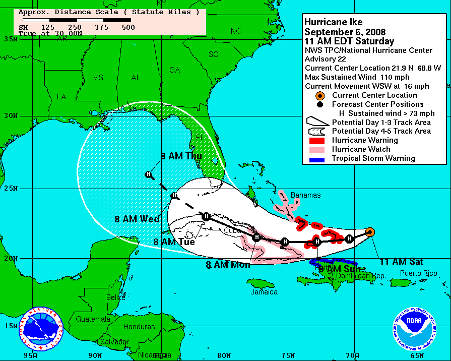
The NHC track has Ike in the Gulf of Mexico Thursday morning next week, and they do suggest Ike will be a little west of 85W. Needless to say, at this point nobody knows the final track or intensity of Ike, but let me show you why I still am not convinced Ike will make it west of 85W. First off, the official NHC track:
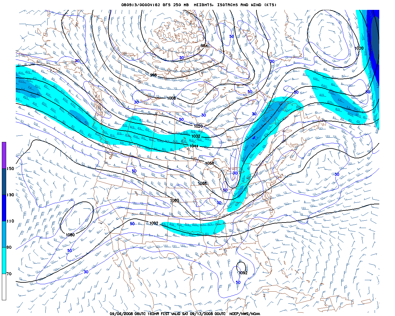
Now… there is the GFS 250 mb prog for the middle of next week. Note the upper trough moving through the eastern half of the nation; that should turn Ike north, and then northeast at some point next week. It is very rare for any tropical cyclone above 25N to keep moving west across the Gulf of Mexico in September (that happens mainly in August, when the mid latitude westerlies are still well to the north)
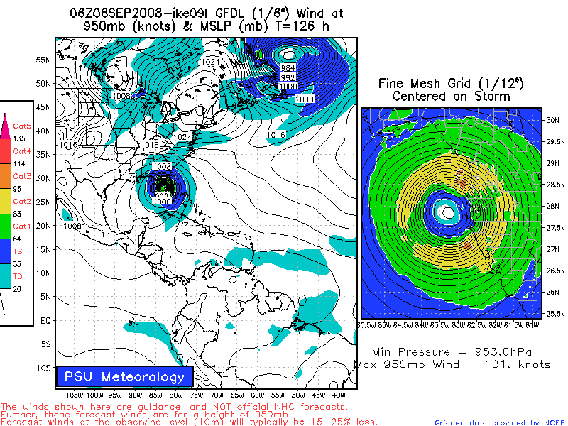
Here is the GFDL idea; it keeps Ike east of 85W, and turns it toward Tampa Bay:
And, the GFS hints that Ike will make landfall near Cedar Key, with a northeast motion toward Jacksonville and the Atlantic:

I believe the greatest landfall risk now is along the Florida West Coast from Cedar Key south to Fort Myers, including the Tampa Bay area. This idea means Alabama stays on dry side with little rain or impact here.
But, this thing is going to do what is going to do without reading blogs or looking at computer models, so we all wait and watch…



