


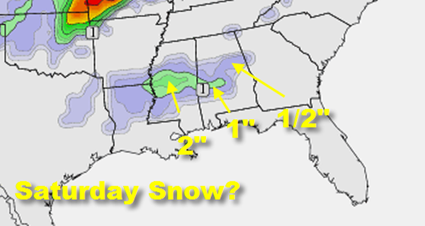
The morning run of the GFS introduced a new idea: a very cold trough sweeping across Mississippi and Alabama on Saturday, accompanied by the potential for a wintry mix.
This is the output for the GFS snow depth product by Saturday night.
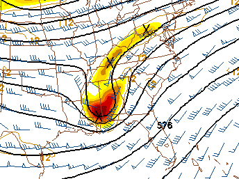
Here is the culprit:
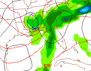
This is the precipitation and 540 thickness line, a useful rule of thumb for the rain/snow line (the blue dotted line).
This idea is voodoo for now, but something that we will be watching.



