


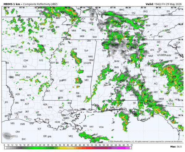
RADAR CHECK: Again today we have the classic case of random, scattered showers and thunderstorms across Alabama this afternoon in the ocean of humidity in place. Some spots are getting a good downpour, others have a partly sunny sky. Showers will fade tonight after sunset.
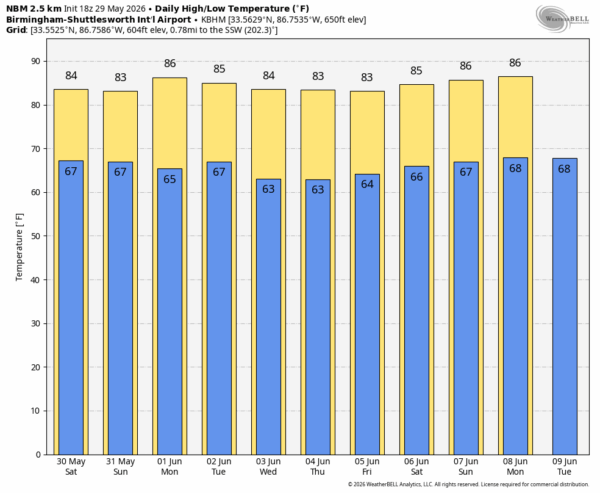
The overall weather pattern across Alabama won’t change much through the weekend. Partly sunny, warm, humid days with the daily dose of scattered, mostly afternoon and evening showers and thunderstorms. The chance of any one spot seeing a shower each day is 50-60 percent, afternoon highs will be generally in the mid 80s.
NEXT WEEK: An upper ridge begins to build over the region, meaning a trend toward fewer showers through the week. Understand the chance of rain isn’t zero, but afternoon showers will be more widely spaced. Global models suggest we could see a higher coverage of showers and storms late in the week over the far southern part of Alabama… See the video briefing for maps, graphics, and more details.
TROPICS: Hurricane season in the Atlantic basin begins Monday, June 1. All is quiet and tropical storm formation is not expected for at least the next seven days.
ON THIS DATE IN 1968: An F2 tornado moved through parts of Lawrence County; one home and two garages were destroyed near Hatton. Several homes were damaged and several other structures sustained damage.
Look for my next video briefing here by 6:00 a.m. Monday… enjoy the weekend!



