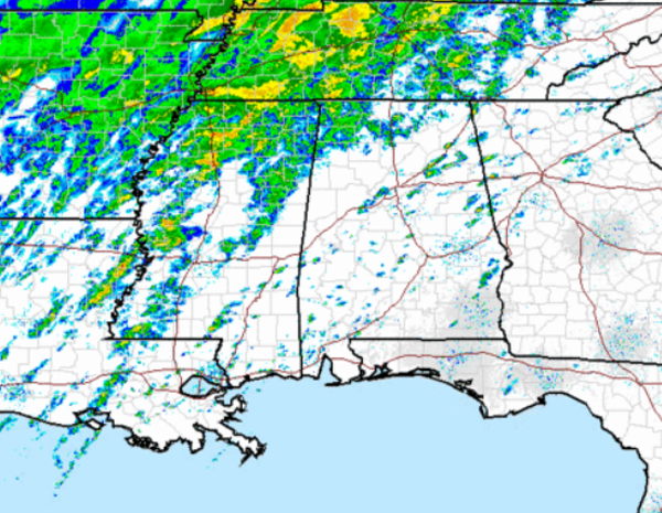
A look at the regional radar early this afternoon shows a lot of precip to our north and west. It is a winter weather nightmare across portions of the Mid-South, where a significant ice storm is underway. Luckily for us in Alabama that winter weather mess stays just to our north. We will have to deal with quite a bit of rain the next few days. Moderate rain is falling across much of north-central Mississippi, and it is heading our direction. There are a few showers across Alabama and maybe even a few rumbles of thunder. It will be a very wet night across the state.
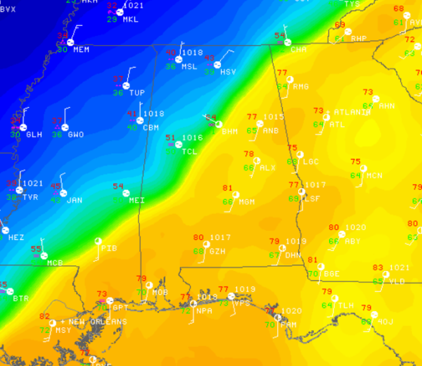
The bigger weather story for the state today is the contrast in temperatures. A cold front has made its way into Central Alabama and we are seeing major temperatures differences over very short distances. The cold front is running parallel to Interstate 59 and if you cross the boundary, you will definitely notice the temperature change. The front is nearly stationary, with movement slowly to the south. The graphic below shows just how the front cuts across the state. Muscle Shoals is at 40, Tuscaloosa is sitting in the lower 50s, Birmingham in the low 60s, but Anniston is in the upper 70s with locations to the south in the 80s.