


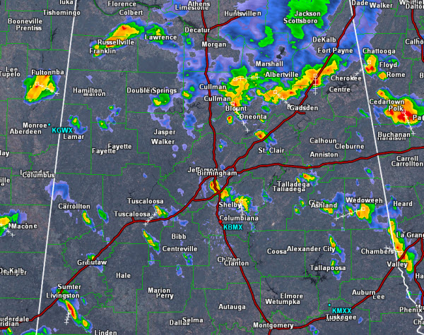
Another active afternoon as the radar has lit up the last couple of hours with widespread summertime convection. Storms are moving in southerly direction across the state and currently the most intense storms in Central Alabama are affecting portions of Clay and Randolph counties.
A broken line of storms are now pushing into Blount, Etowah, and Cherokee counties and should continue a southward progression the next few hours. Elsewhere across Central Alabama, scattered storms are along the Interstate 59 corridor and that includes areas around the Birmingham Metro.
All of the storms are producing gusty winds and tremendous amount of lightning. Many areas are seeing very heavy rain and some isolated flash flooding could occur with any storms this afternoon. Storms should remain below severe limits, but an isolated updraft could intensity and cause any storm to reach severe limits briefly.
Just as we saw yesterday, storms will last into the evening hours and should begin to wind down after the sun sets.



