NEW DAY, OLD FORECAST: Pure tropical air, rich in moisture, will stay in place across Alabama through the end of the week. This means no basic change in the weather… expect scattered to numerous showers and thunderstorms daily. Highest coverage will come during the afternoon and evening hours, but in this situation some late night or morning rain can’t be ruled out.
It won’t rain all day, and it won’t necessarily rain everywhere. But the rain will be heavy in spots, and much of the state is under a flood watch through tonight due to the saturated soil conditions.
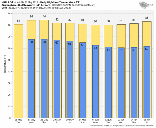
Temperatures will remain below average, with highs generally in the 78-84 degree range.
THE WEEKEND: Pretty much the same story. Some sun, but scattered showers and storms will be around both days, mostly from noon to midnight. Afternoon highs will be in the low 80s.
NEXT WEEK: An upper air pattern change should bring drier conditions to Alabama and the Deep South as June begins. Showers become fewer in number, the amount of sun we see will increase, and afternoons will be warmer. See the video briefing for maps, graphics, and more details.
ON THIS DATE IN 1984: Thunderstorms dropped 6 to 13 inches of rain at Tulsa, OK in 6 hours. The flooding claimed 14 lives and caused $90 million in property damage. 4600 cars, 743 houses, and 387 apartments were destroyed or severely damaged in the flood.
Look for the next video briefing here by 4:00 this afternoon… enjoy the day!