


Thunderstorms are already developing in central Alabama at 341 pm, mainly south of I-20. These storms are developing along a boundary, or cool front, left behind by this morning’s rain over north Alabama. Temperatures have reached the lower 90s at Tuscaloosa, but it is still only 86 in Clay and 82 in Gadsden. These storms will move northeast, and reach much of the BHM and TCL metro areas over the next 2 hours. Drive carefully on the way home today, since these storms contain very heavy rain.
To our NW, an upper-level disturbance that is rather strong for this time of year is currently in Arkansas and moving east. It will move NE tonight into Tennessee.
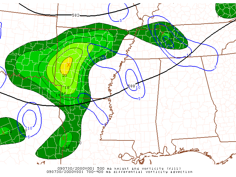
(Upper level flow and vorticity)
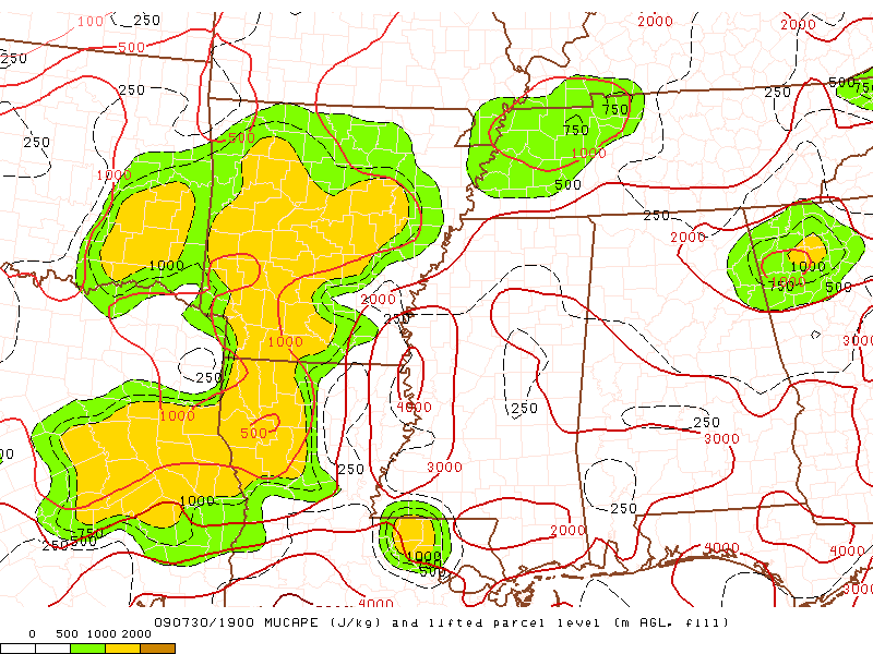
CAPE (instability)
With some upper-level support and very humid, unstable air across Alabama (CAPE over 2,000 J/kg even after sunset), expect additional thunderstorms later tonight. And, with the system to our north, wind fields will actually be stronger than normal in Summer also, and we’ll have a little wind shear tonight. So, the storms overnight may contain damaging winds, hail, and even an isolated tornado. Keep an eye on the weather tonight, and have your NOAA Weather Radio in alert mode.
More storms are possible tomorrow, and many places will see another 1-3″ of rain between now and tomorrow night.



