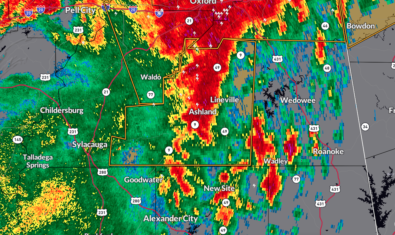
The National Weather Service in Birmingham has issued a Severe Thunderstorm Warning for Clay County in east central Alabama, effective until 7:00 AM CDT.
As of 6:20 AM CDT, a severe thunderstorm was located 7 miles southeast of Waldo, or 7 miles west of Ashland, moving east at 35 mph.
Hazards and Impact
The primary hazard is 60 mph wind gusts, which can cause damage to roofs, siding, and trees.
Locations Impacted
Areas that could be affected include:
Lineville
Ashland
Barfield
Delta
Cleveland Crossroads
Cragford
Hollins
Roselle
Lake Chinnabee
Millerville
Mellow Valley
Gunthertown
Motley
Precautionary Measures
Seek Shelter: Move to an interior room on the lowest floor of a building to stay safe from strong winds.
Stay Alert: Keep monitoring local weather updates and heed any instructions from local authorities.
Take necessary precautions to ensure your safety during this severe thunderstorm warning period. Stay safe and stay informed.