


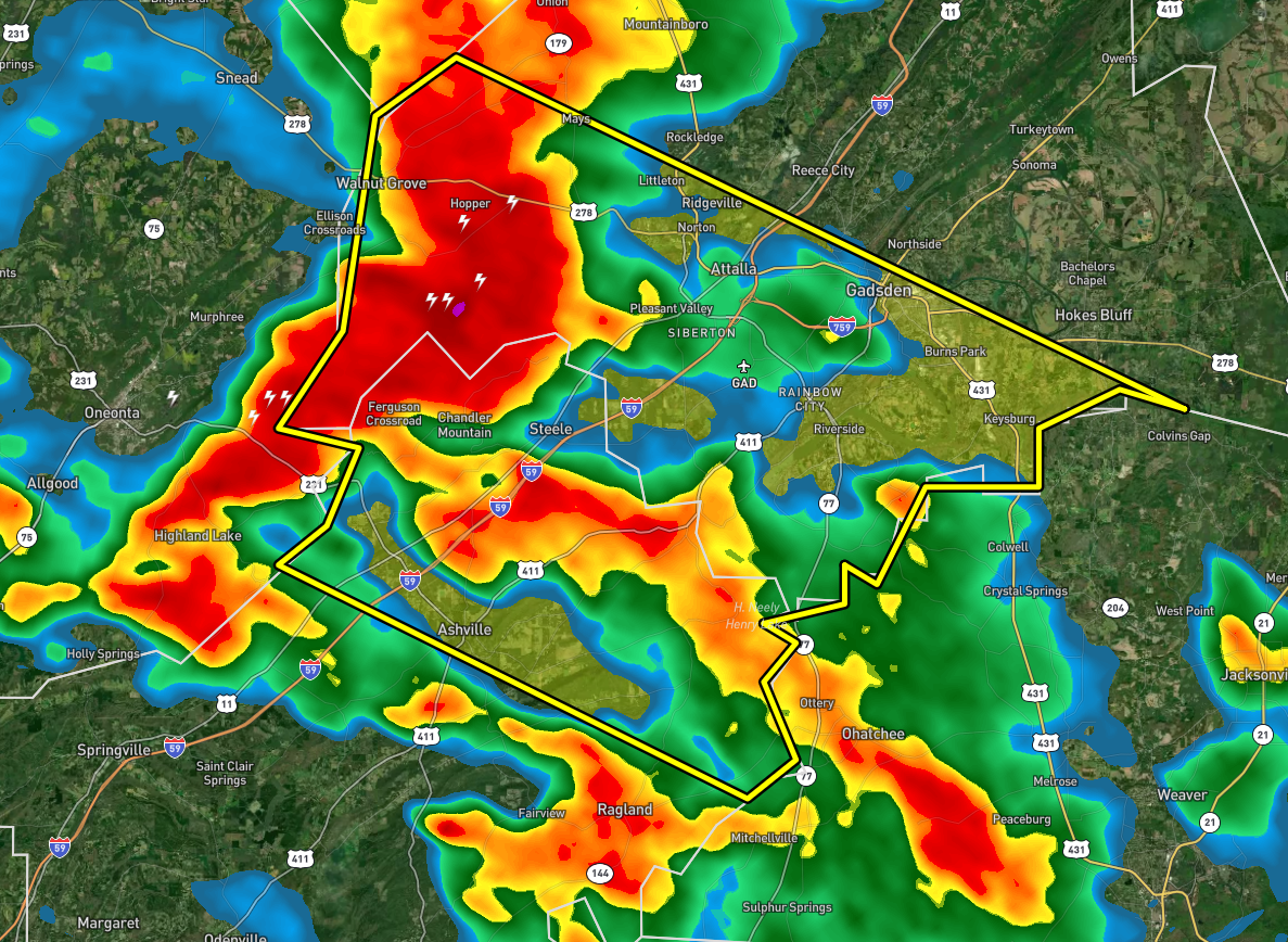
BULLETIN – IMMEDIATE BROADCAST REQUESTED
Severe Thunderstorm Warning
National Weather Service Birmingham AL
431 PM CDT Sat Jul 9 2022
The National Weather Service in Birmingham has issued a
* Severe Thunderstorm Warning for…
Central Etowah County in northeastern Alabama…
Northeastern St. Clair County in central Alabama…
* Until 530 PM CDT.
* At 431 PM CDT, a severe thunderstorm was located near Altoona, or
10 miles west of Attalla, moving southeast at 20 mph.
HAZARD…60 mph wind gusts.
SOURCE…Radar indicated.
IMPACT…Expect damage to roofs, siding, and trees.
* Locations impacted include…
Gadsden, Rainbow City, Attalla, Hokes Bluff, Glencoe, Ashville,
Ragland, Steele, Altoona, Walnut Grove, Reece City, Gadsden Mall,
Neely Henry Lake, Southside, Whitney Junction, Alabama
International Dragway, Gadsden Steam Plant, I 59 Rest Areas At
Oneonta, Cobb City and Ramsey.
PRECAUTIONARY/PREPAREDNESS ACTIONS…
For your protection move to an interior room on the lowest floor of a
building.



