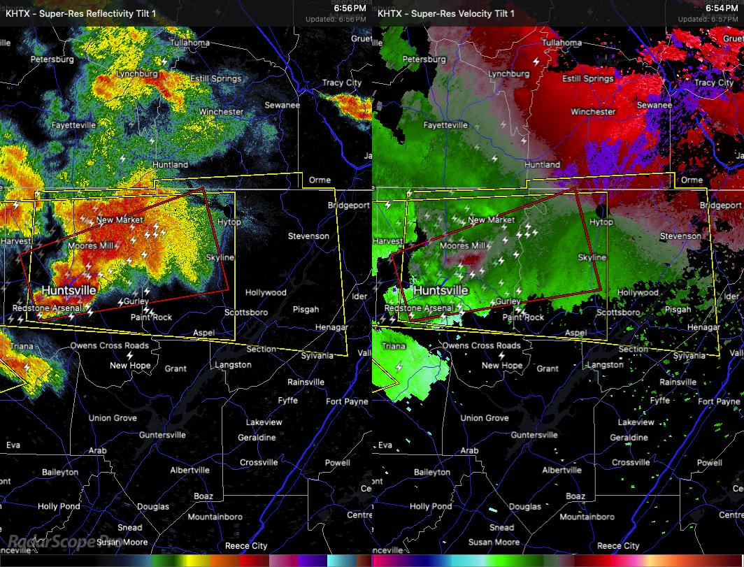
The National Weather Service in Huntsville has issued a Severe Thunderstorm Warning for Jackson County in northeastern Alabama, Madison County in north central Alabama, Central DeKalb County in northeastern Alabama, and Southern Franklin County in Middle Tennessee. This warning is in effect until 7:45 PM CDT.
At 6:54 PM CDT, a severe thunderstorm was located over Huntsville, moving east at 55 miles per hour. The storm is producing hail up to two inches in diameter along with wind gusts reaching 60 miles per hour. Radar has confirmed these hazardous conditions.
People and animals outdoors are at risk of injury. Expect hail damage to roofs, siding, windows, and vehicles, as well as wind damage to roofs, siding, and trees. Locations impacted include Huntsville, Lim Rock, Jericho, Marshall Space Flight Center, Larkin, Francisco, Pisgah, Rosalie, Hazel Green, and Fisk.
For safety, move to an interior room on the lowest floor of a sturdy building. A Tornado Watch remains in effect until 10:00 PM CDT for north central and northeastern Alabama, as well as Middle Tennessee.