


…A SEVERE THUNDERSTORM WARNING REMAINS IN EFFECT UNTIL 745 PM CST FOR NORTHEASTERN BARBOUR COUNTY… At 726 PM CST, severe thunderstorms were located along a line extending from near Hawkinsville to near Osco, moving northeast at 50 mph.
HAZARD…60 mph wind gusts.
SOURCE…Radar indicated.
IMPACT…Expect damage to roofs, siding, and trees. Locations impacted include… White Oak, Hawkinsville, Lakepoint Resort State Park and Lugo.
A Severe Thunderstorm Warning Remains In Effect Until 7:45 PM CST For Northeastern Barbour County
Jan 23rd @ 7:14 pm

…A SEVERE THUNDERSTORM WARNING REMAINS IN EFFECT UNTIL 745 PM CST FOR NORTHEASTERN BARBOUR COUNTY… At 714 PM CST, severe thunderstorms were located along a line extending from near Spring Hill to near Clayton, moving east at 40 mph.
HAZARD…60 mph wind gusts.
SOURCE…Radar indicated.
IMPACT…Expect damage to roofs, siding, and trees. Locations impacted include… Clayton, Hawkinsville, Spring Hill, White Oak, Comer, Barbour County Public Lake Dam, Lakepoint Resort State Park, Lugo and Batesville.
Severe Thunderstorm Warning Issued For Parts Of Barbour And Bullock Counties Until 7:45PM
Jan 23rd @ 6:55 pm
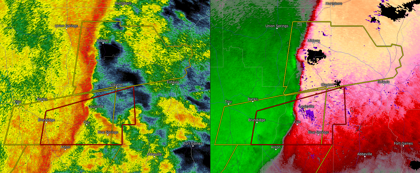

The National Weather Service in Birmingham has issued a
* Severe Thunderstorm Warning for…
Southeastern Bullock County in southeastern Alabama…
Northern Barbour County in southeastern Alabama…
* Until 745 PM CST.
* At 655 PM CST, severe thunderstorms were located along a line extending from near Midway to Boot Hill, moving northeast at 60 mph.
HAZARD…60 mph wind gusts.
SOURCE…Radar indicated.
IMPACT…Expect damage to roofs, siding, and trees.
* Locations impacted include…
Midway, Clayton, Pickett, Hawkinsville, Spring Hill, Comer, Barbour
County Public Lake Dam, White Oak, Lakepoint Resort State Park, Boot Hill, Batesville, Clayton Municipal Airport, Twin Springs, Lugo, Three Notch and Mount Andrew.



