


…THE SEVERE THUNDERSTORM WARNING FOR SOUTHEASTERN BLOUNT… NORTHEASTERN JEFFERSON AND NORTHWESTERN ST. CLAIR COUNTIES IS CANCELLED… The storm which prompted the warning has weakened below severe limits, and no longer poses an immediate threat to life or property. Therefore the warning has been cancelled. However small hail and gusty winds are still possible with this thunderstorm. To report severe weather, contact your nearest law enforcement agency. They will relay your report to the National Weather Service Birmingham.
Severe Thunderstorm Warning Continues For Parts Of Blount, Jefferson, And St. Clair Counties Until 12:30PM
May 12th @ 11:44 am

…A SEVERE THUNDERSTORM WARNING REMAINS IN EFFECT UNTIL 1230 PM CDT FOR SOUTHEASTERN BLOUNT…NORTHEASTERN JEFFERSON AND NORTHWESTERN ST. CLAIR COUNTIES… At 1201 PM CDT, a severe thunderstorm was located near Clay, or near Springville, moving east at 25 mph.
HAZARD…60 mph wind gusts and quarter size hail.
SOURCE…Radar indicated.
IMPACT…Hail damage to vehicles is expected. Expect wind damage to roofs, siding, and trees. Locations impacted include… Trussville, Oneonta, Springville, Pinson-Clay-chalkv, Center Point, Clay, Pinson, Argo, Ashville, Chalkville, Highland Lake, Whitney Junction, Palmerdale, St. Clair Springs, Holly Springs, Village Springs, Caldwell, Horse Pens Forty, I 59 Rest Areas At Oneonta and Remlap.
Severe Thunderstorm Warning Issued For Parts Of Blount, Jefferson, And St. Clair Counties Until 12:30PM
May 12th @ 11:44 am
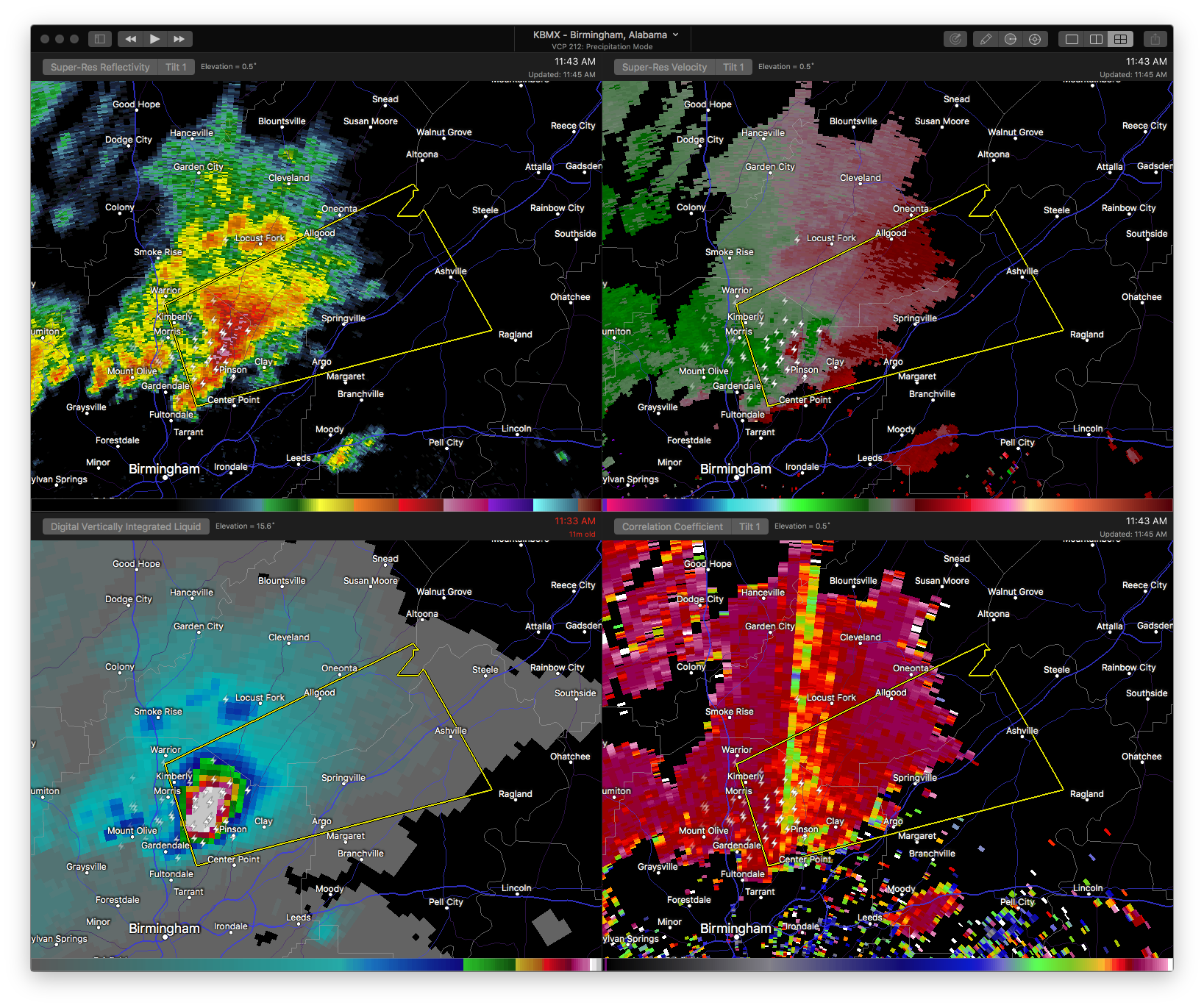

The National Weather Service in Birmingham has issued a
* Severe Thunderstorm Warning for…
Southeastern Blount County in Alabama…
Northeastern Jefferson County in Alabama…
Northwestern St. Clair County in Alabama…
* Until 1230 PM CDT
* At 1143 AM CDT, a severe thunderstorm was located near Pinson, or near Pinson-Clay-chalkv, moving east at 25 mph.
HAZARD…60 mph wind gusts and quarter size hail.
SOURCE…Radar indicated.
IMPACT…Hail damage to vehicles is expected. Expect wind damage to roofs, siding, and trees.
* Locations impacted include…
Trussville, Gardendale, Fultondale, Oneonta, Springville, Pinson-Clay-chalkv, Dallas, Center Point, Clay, Pinson, Margaret, Argo, Warrior, Kimberly, Ashville, Morris, Locust Fork, Trafford, Allgood and County Line.



