


…THE SEVERE THUNDERSTORM WARNING FOR SOUTHEASTERN DALLAS COUNTY IS CANCELLED…
The storms which prompted the warning have weakened below severe limits, and no longer pose an immediate threat to life or property. Therefore, the warning has been cancelled. However gusty winds are still possible with these thunderstorms. A Severe Thunderstorm Watch remains in effect until 600 PM CDT for central and south central Alabama. LAT…LON 3218 8704 3225 8714 3253 8690 3246 8686
A Severe Thunderstorm Warning Remains In Effect Until 4:45 PM CDT For Southeastern Dallas County
May 4th @ 4:13 pm

…A SEVERE THUNDERSTORM WARNING REMAINS IN EFFECT UNTIL 445 PM CDT FOR SOUTHEASTERN DALLAS COUNTY… At 413 PM CDT, severe thunderstorms were located along a line extending from Old Cahaba Park to 6 miles southeast of Belknap, moving northeast at 45 mph.
HAZARD…60 mph wind gusts.
SOURCE…Radar indicated.
IMPACT…Expect damage to roofs, siding, and trees. Locations impacted include… Selma, Selmont-West Selmont, Dallas Lake, Belknap, Gardner Island, Burnsville, Tyler, Selma Drag Strip and Craig Field Aiport.
A Severe Thunderstorm Warning Remains In Effect Until 4:45 PM CDT For Southeastern Dallas County
May 4th @ 4:06 pm

…A SEVERE THUNDERSTORM WARNING REMAINS IN EFFECT UNTIL 445 PM CDT FOR SOUTHEASTERN DALLAS COUNTY… At 405 PM CDT, severe thunderstorms were located along a line extending from 6 miles northeast of Dannelly Reservoir to 7 miles south of Belknap, moving northeast at 45 mph.
HAZARD…60 mph wind gusts.
SOURCE…Radar indicated.
IMPACT…Expect damage to roofs, siding, and trees. Locations impacted include… Selma, Selmont-West Selmont, Dallas Lake, Belknap, Gardner Island, Burnsville, Tyler, Dannelly Reservoir, Selma Drag Strip and Craig Field Aiport.
Severe Thunderstorm Warning Issued For Parts Of Dallas County Until 4:45PM
May 4th @ 3:54 pm
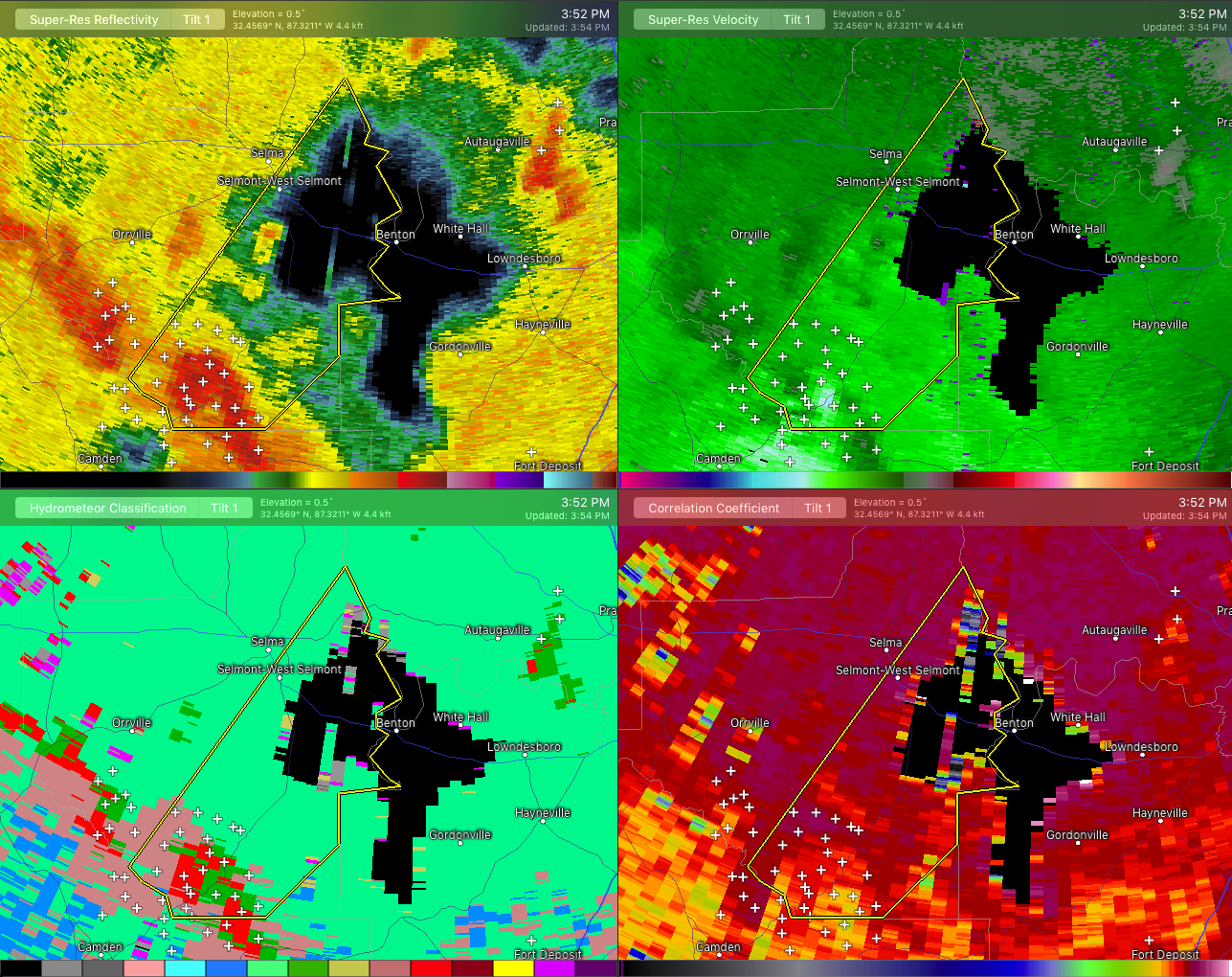

The National Weather Service in Birmingham has issued a
* Severe Thunderstorm Warning for…
Southeastern Dallas County in south central Alabama…
* Until 445 PM CDT.
* At 353 PM CDT, a severe thunderstorm was located near Dannelly
Reservoir, or 13 miles northeast of Camden, moving northeast at 45 mph.
HAZARD…60 mph wind gusts.
SOURCE…Radar indicated.
IMPACT…Expect damage to roofs, siding, and trees.
* Locations impacted include…
Selma, Selmont-West Selmont, Dallas Lake, Belknap, Dannelly
Reservoir, Gardner Island, Burnsville, Tyler, Selma Drag Strip, Tilden, Carlowville and Craig Field Aiport.



