


…THE SEVERE THUNDERSTORM WARNING FOR CENTRAL MACON COUNTY WILL
EXPIRE AT 930 PM CDT…
The storm which prompted the warning has weakened below severe
limits, and no longer poses an immediate threat to life or property.
Therefore the warning will be allowed to expire.
A tornado watch remains in effect until 1000 PM CDT for southeastern
and east central Alabama. A tornado watch also remains in effect
until 100 AM CDT for southeastern and east central Alabama.
Severe Thunderstorm Warning Continues For Parts Of Macon County Until 9:30PM
Apr 5th @ 8:47 pm

…A SEVERE THUNDERSTORM WARNING REMAINS IN EFFECT UNTIL 930 PM CDT FOR CENTRAL MACON COUNTY… At 911 PM CDT, a severe thunderstorm was located over Tuskegee, moving northeast at 50 mph.
HAZARD…60 mph wind gusts and quarter size hail.
SOURCE…Radar indicated.
IMPACT…Hail damage to vehicles is expected. Expect wind damage to roofs, siding, and trees. Locations impacted include… Tuskegee, Notasulga, Franklin, Liverpool, Tuskegee National Forest, Lake Tuskegee, I 85 Rest Area, Uphapee Creek and Moton Field Municipal Airport.
Severe Thunderstorm Warning Continues For Parts Of Macon County Until 9:30PM
Apr 5th @ 8:47 pm

…A SEVERE THUNDERSTORM WARNING REMAINS IN EFFECT UNTIL 930 PM CDT FOR CENTRAL MACON COUNTY… At 900 PM CDT, a severe thunderstorm was located over Milstead, moving northeast at 50 mph.
HAZARD…60 mph wind gusts and quarter size hail.
SOURCE…Radar indicated.
IMPACT…Hail damage to vehicles is expected. Expect wind damage to roofs, siding, and trees. Locations impacted include… Tuskegee, Notasulga, Milstead, Shorter, Franklin, Liverpool, Lake Tuskegee, Tuskegee National Forest, Liberty City, I 85 Rest Area, Uphapee Creek, Moton Field Municipal Airport and Cross Keys.
Severe Thunderstorm Warning Canceled For Parts Of Elmore, Montgomery, And Tallapoosa Counties
Apr 5th @ 8:47 pm
…THE SEVERE THUNDERSTORM WARNING FOR SOUTHEASTERN ELMORE…SOUTH CENTRAL TALLAPOOSA AND NORTHEASTERN MONTGOMERY COUNTIES IS CANCELLED… The severe thunderstorm which prompted the warning has moved out of the warned area. Therefore, the warning has been cancelled. A tornado watch remains in effect until 1000 PM CDT for southeastern and east central Alabama. A tornado watch also remains in effect until 100 AM CDT for southeastern and east central Alabama.
Severe Thunderstorm Warning Issued For Parts Of Elmore, Macon, Montgomery, And Tallapoosa Counties Until 9:30PM
Apr 5th @ 8:47 pm
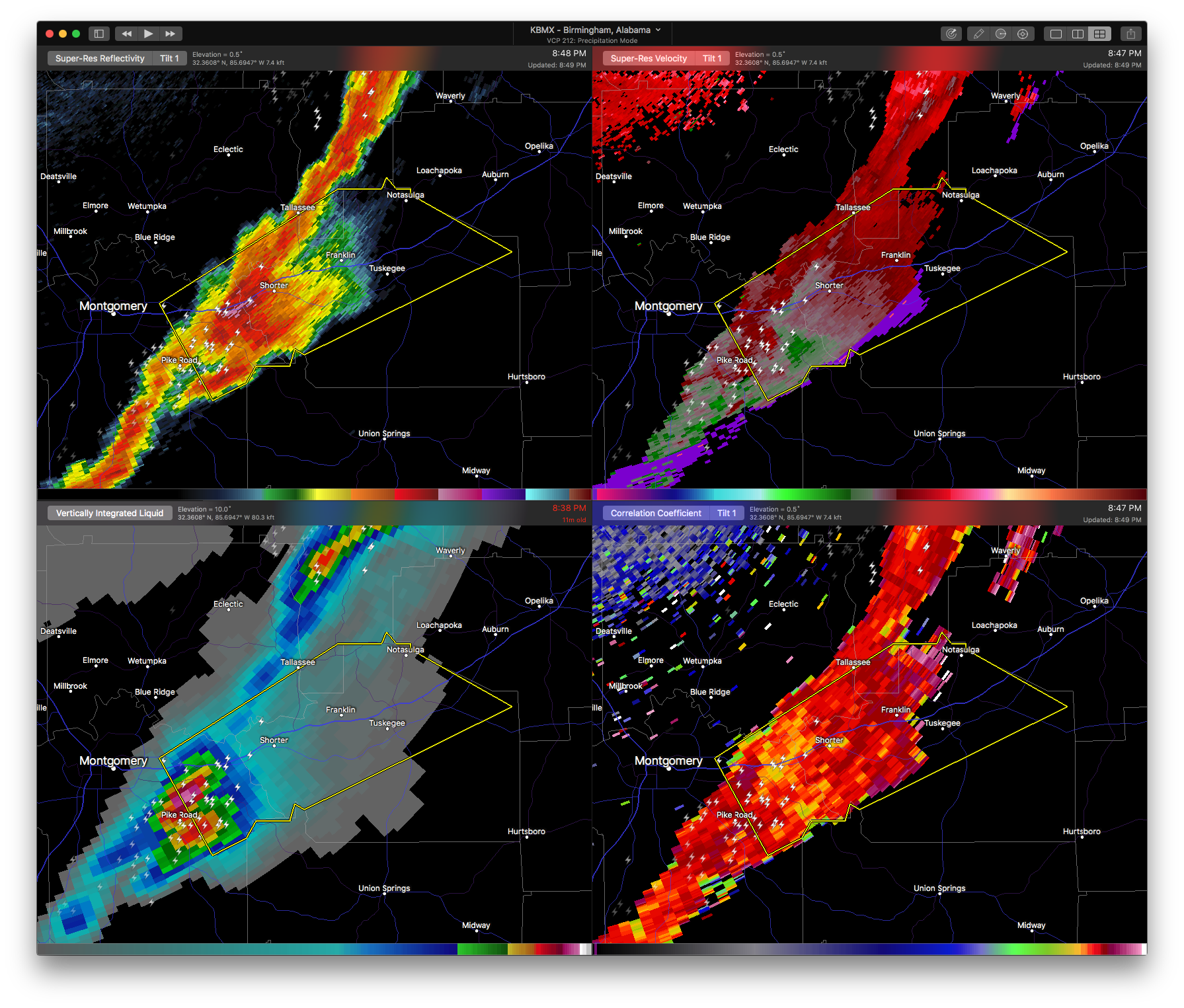
This storm is showing signs of broad rotation and could be upgraded to a Tornado Warning if the rotation tightens.

The National Weather Service in Birmingham has issued a
* Severe Thunderstorm Warning for…
Southeastern Elmore County in east central Alabama…
Central Macon County in southeastern Alabama…
South central Tallapoosa County in east central Alabama…
Northeastern Montgomery County in south central Alabama…
* Until 930 PM CDT
* At 846 PM CDT, a severe thunderstorm was located over Waugh, or 10 miles southwest of Milstead, moving northeast at 50 mph.
HAZARD…60 mph wind gusts and half dollar size hail.
SOURCE…Radar indicated.
IMPACT…Hail damage to vehicles is expected. Expect wind damage to roofs, siding, and trees.
* Locations impacted include…
Montgomery, Tuskegee, Tallassee, Notasulga, Milstead, Shorter, Franklin, Auburn University In Montgomery, Reeves Airport, Lake
Tuskegee, Tuskegee National Forest, Waugh, Liverpool, Tallapoosa
City, Mount Meigs, Tysonville, Victoryland, Liberty City, Mitylene and Uphapee Creek.



