


…THE SEVERE THUNDERSTORM WARNING FOR NORTHWESTERN LAUDERDALE COUNTY
WILL EXPIRE AT 1245 PM CDT…
The storm which prompted the warning has moved out of the area.
Therefore, the warning will be allowed to expire.
A Tornado Watch remains in effect until 700 PM CDT for northwestern
Alabama.
A Severe Thunderstorm Warning Remains In Effect Until 12:45 PM CDT For Northwestern Lauderdale County
Mar 14th @ 12:31 pm

…A SEVERE THUNDERSTORM WARNING REMAINS IN EFFECT UNTIL 1245 PM CDT FOR NORTHWESTERN LAUDERDALE COUNTY… At 1231 PM CDT, a severe thunderstorm was located near J P Coleman State Park, moving northeast at 45 mph.
HAZARD…60 mph wind gusts.
SOURCE…Radar indicated.
IMPACT…Expect damage to roofs, siding, and trees. This severe thunderstorm will remain over mainly rural areas of northwestern Lauderdale County.
Severe Thunderstorm Warning Issued For Parts Of Lauderdale County Until 12:45PM
Mar 14th @ 12:18 pm
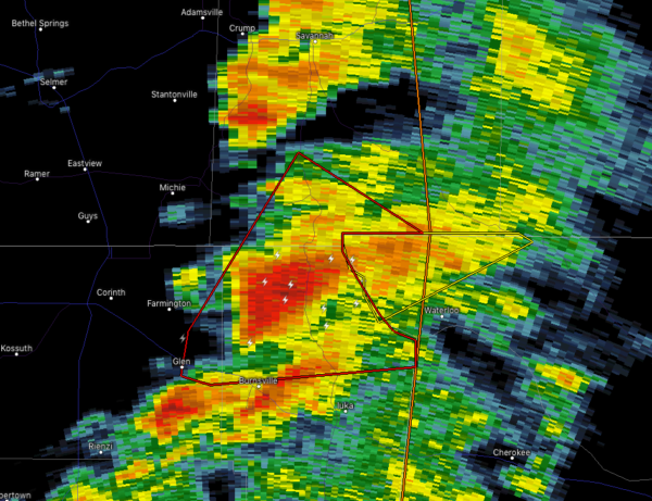

The National Weather Service in Huntsville Alabama has issued a
* Severe Thunderstorm Warning for…
Northwestern Lauderdale County in northwestern Alabama…
* Until 1245 PM CDT.
* At 1216 PM CDT, a severe thunderstorm was located near Burnsville, or 8 miles west of J P Coleman State Park, moving northeast at 45 mph.
HAZARD…60 mph wind gusts.
SOURCE…Radar indicated.
IMPACT…Expect damage to roofs, siding, and trees.
* This severe thunderstorm will remain over mainly rural areas of northwestern Lauderdale County.



