


…A SEVERE THUNDERSTORM WARNING REMAINS IN EFFECT UNTIL 645 PM CST FOR EAST CENTRAL MARION COUNTY… At 630 PM CST, a severe thunderstorm was located near Brinn, or near Hamilton, moving east at 30 mph.
HAZARD…60 mph wind gusts and quarter size hail. This storm has produced hail from nickle to quarter size.
SOURCE…Radar indicated.
IMPACT…Hail damage to vehicles is expected. Expect wind damage to roofs, siding, and trees. Locations impacted include… Hamilton, Lake Buttahatchee, Brinn, Rankin Fite Airport, Pearces Mill and Piney Grove.
Severe Thunderstorm Warning Continues For Parts Of Marion County Until 6:45PM
Mar 9th @ 5:50 pm

…A SEVERE THUNDERSTORM WARNING REMAINS IN EFFECT UNTIL 645 PM CST FOR CENTRAL MARION COUNTY… At 620 PM CST, a severe thunderstorm was located over Hamilton, moving east at 30 mph.
HAZARD…60 mph wind gusts and quarter size hail.
SOURCE…Radar indicated.
IMPACT…Hail damage to vehicles is expected. Expect wind damage to roofs, siding, and trees. Locations impacted include… Hamilton, Weston, Lake Buttahatchee, Brinn, Rankin Fite Airport, Pearces Mill and Piney Grove.
Severe Thunderstorm Warning Continues For Parts Of Marion County Until 6:45PM
Mar 9th @ 5:50 pm
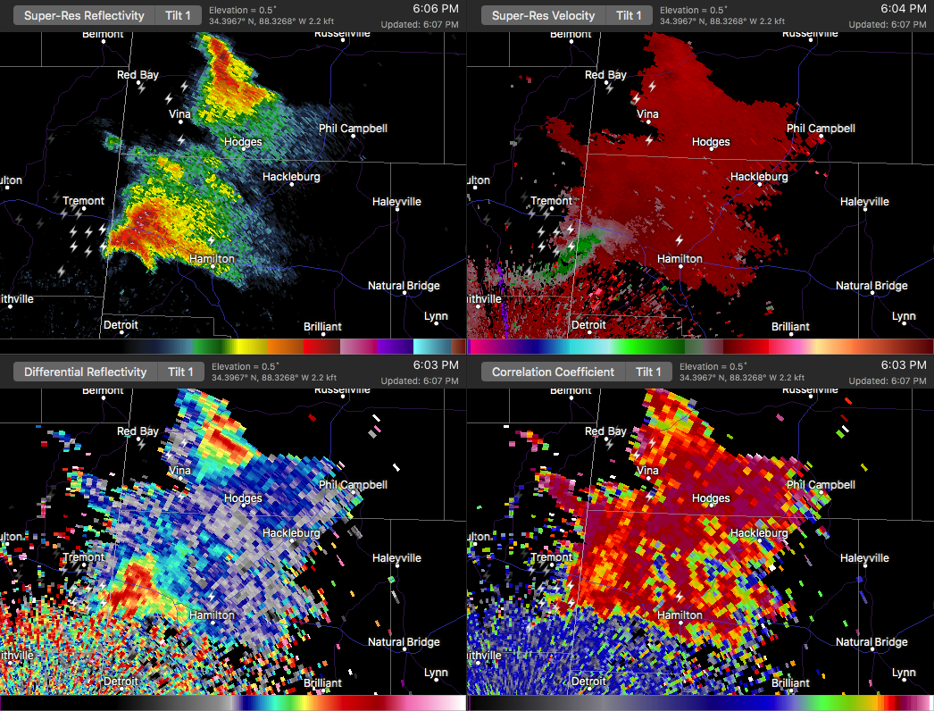
Storm appears to be weakening some, but is still capable of producing large hail and damaging winds. Should be moving into an area of dramatically reduced shear, and storm strength should drop.

…A SEVERE THUNDERSTORM WARNING REMAINS IN EFFECT UNTIL 645 PM CST FOR CENTRAL MARION COUNTY… At 606 PM CST, a severe thunderstorm was located near Weston, or 7 miles northwest of Hamilton, moving east at 30 mph.
HAZARD…60 mph wind gusts and half dollar size hail.
SOURCE…Radar indicated.
IMPACT…Hail damage to vehicles is expected. Expect wind damage to roofs, siding, and trees. Locations impacted include… Hamilton, Weston, Lake Buttahatchee, Brinn, Bexar, Pearces Mill, Rankin Fite Airport and Piney Grove.
Severe Thunderstorm Warning Continues For Parts Of Marion County Until 6:45PM
Mar 9th @ 5:50 pm
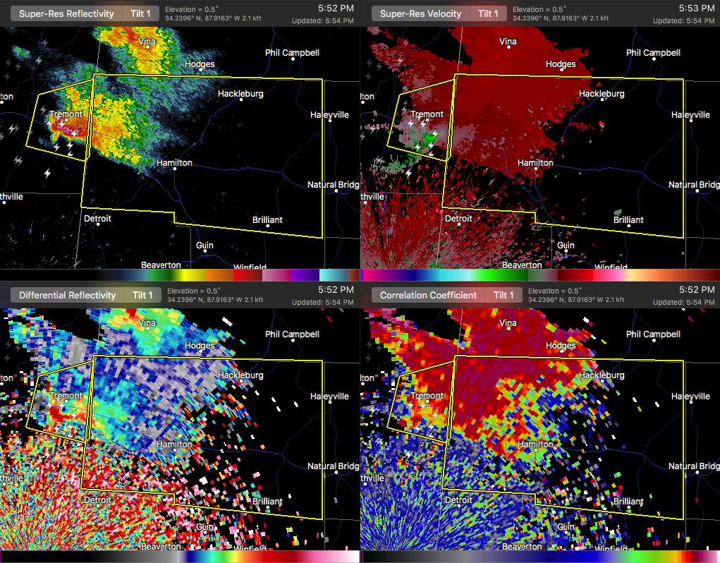
A severe thunderstorm is about to move across the state line into the western parts of Marion County, and will soon affect the areas of Hamilton and Hackleburg. This storm is showing signs of broad rotation, and is putting out plenty of cloud to ground lightning. Hail up to 2 inches in diameter possible especially close to Bexar.

…A SEVERE THUNDERSTORM WARNING REMAINS IN EFFECT UNTIL 645 PM CST FOR CENTRAL MARION COUNTY… At 553 PM CST, a severe thunderstorm was located near Tremont, or 11 miles southeast of Fulton, moving east at 30 mph.
HAZARD…60 mph wind gusts and half dollar size hail.
SOURCE…Radar indicated.
IMPACT…Hail damage to vehicles is expected. Expect wind damage to roofs, siding, and trees. Locations impacted include… Hamilton, Weston, Lake Buttahatchee, Brinn, Bear Creek, Tessner, Bexar, Shottsville, Pearces Mill, Rankin Fite Airport and Piney Grove.
Severe Thunderstorm Warning Issued For Parts Of Marion County Until 6:45PM
Mar 9th @ 5:50 pm

The National Weather Service in Birmingham has issued a
* Severe Thunderstorm Warning for…
Marion County in northwestern Alabama…
* Until 645 PM CST
* At 550 PM CST, a severe thunderstorm was located over Tremont, or 9 miles southeast of Fulton, moving east at 30 mph.
HAZARD…60 mph wind gusts and half dollar size hail.
SOURCE…Radar indicated.
IMPACT…Hail damage to vehicles is expected. Expect wind damage to roofs, siding, and trees.
* Locations impacted include…
Hamilton, Hackleburg, Brilliant, Brinn, Weston, Lake Buttahatchee, Bear Creek, Tessner, Shottsville, Pearces Mill, Rankin Fite
Airport, Upper Bear Creek Reservoir, Byrd, Bexar, Pigeye, Marion
County Public Lake, Piney Grove and Pikeville.



