


…THE SEVERE THUNDERSTORM WARNING FOR NORTHERN ST. CLAIR COUNTY IS CANCELLED… The storm which prompted the warning has moved out of the area. Therefore the warning has been cancelled. A tornado watch remains in effect until 900 PM CDT for northeastern Alabama.
Severe Thunderstorm Warning Continues For Parts Of St. Clair County Until 7:00PM
Apr 5th @ 5:57 pm

…A SEVERE THUNDERSTORM WARNING REMAINS IN EFFECT UNTIL 700 PM CDT FOR NORTHERN ST. CLAIR COUNTY… At 617 PM CDT, a severe thunderstorm was located near Odenville, moving northeast at 55 mph.
HAZARD…Ping pong ball size hail and 60 mph wind gusts.
SOURCE…Trained weather spotters.
IMPACT…People and animals outdoors will be injured. Expect hail damage to roofs, siding, windows, and vehicles. Expect wind damage to roofs, siding, and trees. Locations impacted include… Rainbow City, Springville, Ashville, Steele, Whitney Junction, Alabama International Dragway, St. Clair Springs, Caldwell, Horse Pens Forty, I 59 Rest Areas At Oneonta and Camp Sumatanga.
Severe Thunderstorm Warning Issued For Parts Of St. Clair County Until 7:00PM
Apr 5th @ 5:57 pm
TENNIS BALL SIZED HAIL!
Local Storm Report by NWS BMX: 1 SSW Irondale [Jefferson Co, AL] public reports HAIL of tennis ball size (M2.50 INCH) at 05:57 PM CDT –
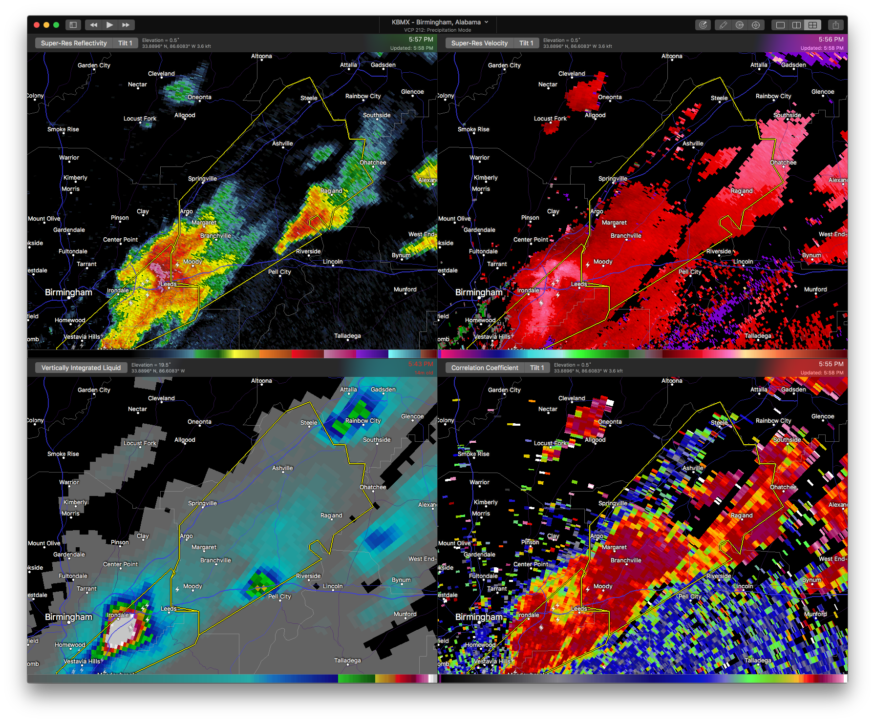

The National Weather Service in Birmingham has issued a
* Severe Thunderstorm Warning for…
St. Clair County in Alabama…
* Until 700 PM CDT
* At 556 PM CDT, a severe thunderstorm was located over Shops Of
Grand River, or over Leeds, moving northeast at 55 mph.
HAZARD…Golf ball size hail.
SOURCE…Trained weather spotters.
IMPACT…People and animals outdoors will be injured. Expect damage to roofs, siding, windows, and vehicles.
* Locations impacted include…
Trussville, Pell City, Leeds, Moody, Rainbow City, Springville, Odenville, Margaret, Argo, Ashville, Riverside, Ragland, Steele, Bald Rock, Branchville, Whitney Junction, Alabama International
Dragway, Wattsville, I 59 Rest Areas At Oneonta and Camp
Winnataska.



