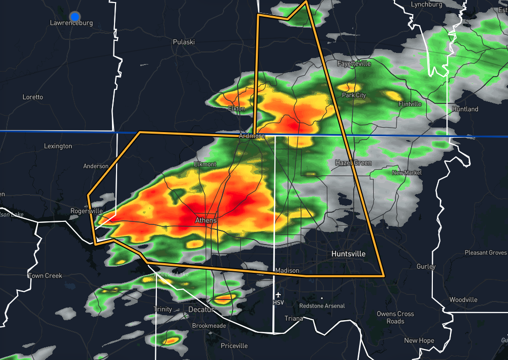
At 1:09 AM CDT, a severe thunderstorm was located 8 miles west of Athens, moving east at 35 mph. The storm poses hazards including 60 mph wind gusts and quarter-size hail, as indicated by radar. These conditions are expected to cause hail damage to vehicles and wind damage to roofs, siding, and trees. Locations impacted include Huntsville, Madison, Athens, Meridianville, Moores Mill, Redstone Arsenal, Hazel Green, Rogersville, Ardmore, and Harvest.
Published on: May 27, 2024 at 1:15 AM
Related Articles
October 24, 2026 at 6:36 AM
Pleasant Weekend on Tap
An upper-level ridge to our west and surface high pressure to the northeast will keep Alabama dry and slightly cooler this weekend. As we head into the week, the ridge will spread further into the state, warming us some and keeping rain chances at bay. Continue reading →
READ MORE
October 23, 2026 at 9:37 PM
Restoring Service after Hurricane Isaias
Alabama Power restored service to about 90% of customers within 24 hours after Hurricane Isaias, mobilizing thousands of workers and advanced storm-planning tools to recover from widespread damage across south Alabama. Continue reading →
READ MORE