


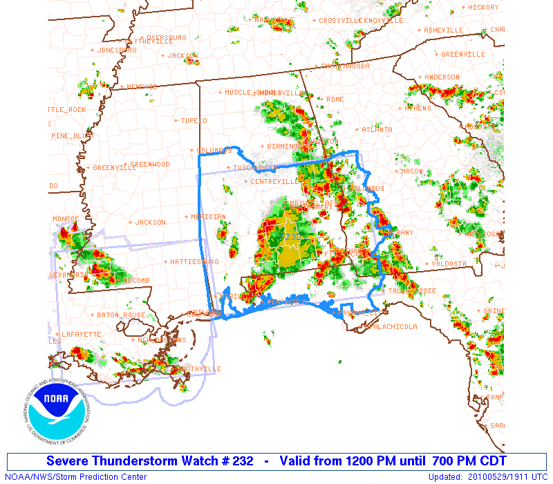
The Storm Prediction Center has issued a severe thunderstorm watch for this afternoon for South Central and South Alabama.
It is valid until 7 p.m. CDT
Counties in the NWS Birmingham County Warning Area include: Autauga, Barbour, Bibb, Bullock, Chambers, Chilton, Coosa, Dallas, Elmore, Greene, Hale, Lee, Lowndes, Macon, Marengo, Montgomery, Perry, Pickens, Pike, Russell, Sumter, Tallapoosa and Tuscaloosa.
Intense heating being allowed by drier air aloft rotating around the upper low to our west will allow for moderate to high instabilities. Relatively low wind shear will result in non-supercell storms that pulse up and down. Still, with relatively cold air aloft, hail will be a good possibility and damaging winds will be possible as well.



