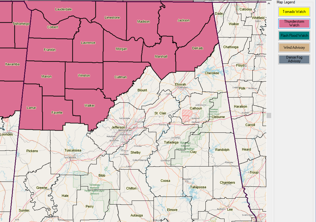
The Storm Prediction Center and local NWS offices in Birmingham, Huntsville, and Nashville have coordinated on a severe thunderstorm watch for northern and northwestern Alabama, northern Mississippi and Middle Tennessee.
It is in effect until 1 a.m. CDT.
Central Alabama counties include: Fayette, Lamar, Marion, Walker and Winston.
North Alabama counties include: Colbert, Cullman, DeKalb, Franklin, Jackson, Lauderdale, Lawrence, Limestone, Madison, Marshall and Morgan.
Your weather radios went off a second time for the watch because of a start time error in the first string of code that computers use to read the watch. There was no change in the watch except for start time, which is now.
Damaging wind is the main threat, with a low threat of tornadoes. There could be hail larger than 1 inch in diameter as well.
If you’ve noticed, instabilities have dropped across Central and North Alabama as dewpoints have lowered this afternoon with daytime heating. They will increase some in coming hours though and there will be sufficient instability for severe storms.
We are watching a strong MCS or mesoscale convective system moving into western Mississippi right now. The head of the system, which looks like a comma head, is near Greenville, Mississippi.
There could be a watch later for areas to the south and east.