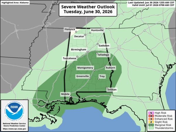
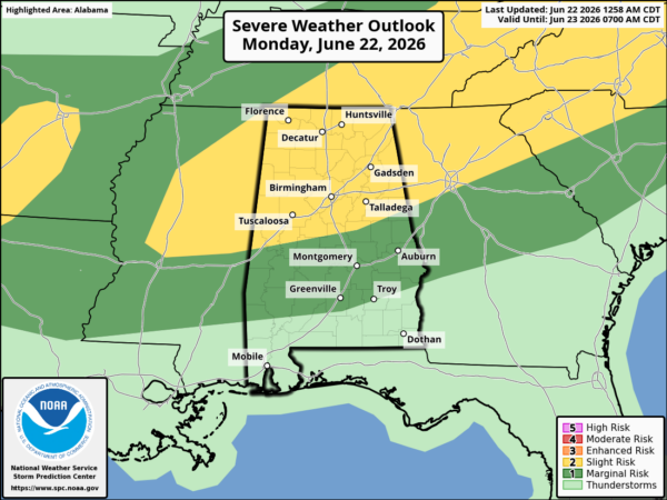
First of all, there is a potential developing for severe weather over Alabama tomorrow, as Brian and Bill mentioned earlier. The latest 12 UTC model runs are still supportive of the possibility of severe weather. It is difficult to predict severe weather this time of year, as warm air and moisture are limited, but here’s the latest.
An upper level disturbance over the SW US today will move into the Midwest tomorrow, bringing surface low pressure toward Alabama. Strong southerly flow will set up ahead of this low tonight and tomorrow, bringing in warm and humid air for this time of year. We may see temps near 70 and dewpoints in the 60s as far north as BHM. But, the instability will be limited, with CAPE near 500 J/kg in BHM, maybe as high as 1000 in south Alabama. Enough for storms, but not really high.
The big deal is the low-level wind fields. Winds will be 40 knots just 2000 feet off the ground, and 50-60 knots 4000 feet up. The storm-relative helicity, or a measure of the wind shear supportive of storm rotation, will be extremely high, with 0-1 km values over 300 in north Alabama, and over 200 as far south as MGM. This type of shear at low-levels will allow any storms that do develop to have the possibility of rotation. Sometimes, though, with that much wind shear and limited instability, many storms that try to get going are quickly disorganized by the shear.
Here’s how it may play out. Rain and storms develop in Mississippi after midnight, then spread into west Alabama during the morning. Some of these storms could be severe, and tornadoes are possible. With the extremely strong winds just off ths surface, any storm downdraft could bring those winds down, producing wind damage. The storms will probably develop into a squall line by noon and move across the state during the afternoon.
Even though any of the storms will have the possibility of producing a tornado almost anywhere in Alabama tomorrow, the best chance for tornadoes may be in west Alabama between 8 am and noon, in any discrete supercells that may develop.
Be sure to have a source of weather information handy tomorrow. If severe storms get going, I may go storm chasing in west Alabama somewhere tomorrow morning. But, this is not a classic set-up for widepsread, large tornadoes.
As far as the Arctic air…it’s interesting how small atmospheric disturbances can trigger much larger ones. By Sunday, a large mass of very cold will have built up in Canada, while it will be cool, but not terribly cold, over most of the U.S. This temperature gradient is unstable, and an upper-level wave will come along and form a low pressure area along the edge of the cold air, helping it to come roaring southward into the eastern U.S. next week.
Here is a loop of temperatures from Sunday night through Thursday morning. The scale is in Celsius (ie., 0 C= 32 F, -5 C =23 F, -10 C = 14 F.) This indicates temps below freezing by New Year’s Day in BHM, in the lower 20s as far south as BHM by Wednesday morning, and in the lower 20s as far south as Enterprise by Thursday morning. The Canadian, European, and NOGAPS are all in general agreement also, except they may show even colder air.
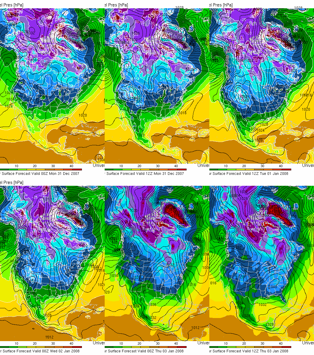

If this forecast holds together, this will be the coldest air we have seen so far this season by far, with many places well into south Alabama dropping to near 20, BHM maybe getting into the teens, and some places in NE Alabama near 10. Also, daytime highs may not even make it much above freezing Tuesday and Wednesday in north Alabama, so the risk of pipes freezing, etc., will be high.