


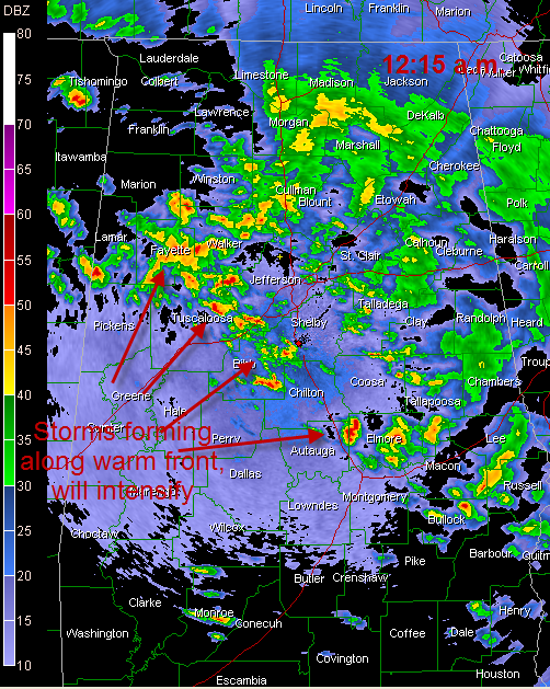
At the midnight hour, showers and storms continue across North and Central Alabama.
The heaviest storms were from Winston through eastern Marion, western Walker, Fayette and northeast Tuscaloosa Counties.
The activity has increased in overall intensity during the past 45 minutes.
There is a good chance that the tornado watch over Mississippi may be moved into Alabama during the early morning hours.
To the west, a tornado warning was in effect a little while ago from a county along this Mississippi/Alabama border. This activity will continue to increase overnight.
Thunderstorms will be likely Saturday morning, as the warm front lifts northward. Some of these storms will become severe with damaging winds and tornadoes.
Then the stage will be set for some firework as moderate to high instability combined with significant wind shear will conspire to produce severe weather and even potentially long tracked supercells tornadoes.



