


The sun is out over parts of central Alabama. Temperatures have risen rather quickly. As of 11 am, BHM 72 TCL 76 NWS 71.
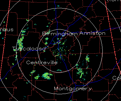
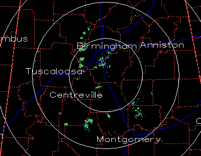
As mentioned earlier, the warm cap above 800 mb is keeping any storms from getting going over Alabama and Mississippi so far. A few showers have developed, but they are staying below the cap. Below is the BMX radar scan from 1108 am at 0.5 degrees elevation above the horizon (top), and 1.5 degrees elevation (bottom). At the lower elevation angle, showers are picked up near Fayette and along the Pickens/Tuscaloosa County line. The radar beam at that range is 5000 ft. altitude, below the cap. At the higher elevation angle, the radar beam is closer to 10000 ft., above the cap. You don’t see the showers.
I did some calculations based on the required surface temperature/moisture content required to break the current cap, and the weakened one forecast by the models this afternoon. For the current cap, we’d have to get to a temp/dewpoint of 85/65, or 80/67, both not likely. But, for a cap weakened by about a 5 degree temperature drop, we would need 75/65 to break the cap. With dewpoints currently 63-65 over much of the area, and temperatures likely above 75 by noon…a weakened cap could be broken, allowing storms to form.
If the cap is broken, the atmosphere is unstable above it, with temperatures quite cold at 500 mb. CAPES could quickly reach 1000 J/kg.
It will all depend on how much the cap is weakened by lifting in the atmosphere. This afternoon/evening is still tough to call.
Either way, the main line of storms will come through late tonight/early tomorrow morning, bringing damaging winds and possibly tornadoes.



