Radars indicate a broken line of thunderstorms from eastern Kentucky, to near Nashville, to west of Memphis. A few storms have formed ahead of the front over northern MS. The area of storms is slowly shifting SE, and should reach the Huntsville area by 6 pm, and come through Birmingham after 10 pm.
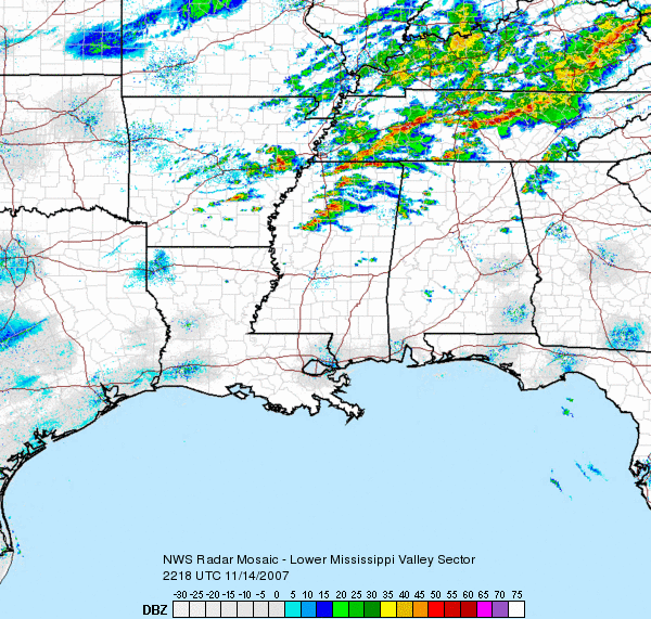
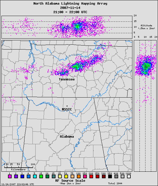
A severe thunderstorm watch continues for parts of NW AL. The storms look strong right now, despite fairly weak instability in west Tennessee. Once the sun goes down, the air will stabilize somewhat due to ground cooling, but this will be very slow to occur, since clouds will prevent much of the cooling and temperatures will also be cooling aloft, balancing it out. So, these storms should hold together, with heavy rain, at least as far south as Cullman, and maybe as far south as Birmingham. They should weaken more as they move into south Alabama. Lightning activity has been fairly limited so far, and mainly in-cloud, as shown by the NASA lightning mapping array for 3-4 pm (below).
Either way, the front itself will bring very gusty winds with it (recent gusts near 40 mph in Memphis without thunder). The NWS has issued a Wind Advisory due to this.
Get ready for much colder air tomorrow and Friday!