


Not a whole lot has changed in the forecast since discussions this morning (scroll down for those). Spring-like system developing over the next 24 hours, with warm, humid air already moving in. Dewpoints in the 60s are already as far north as southern Illinois. There are low clouds and fog over parts of central Alabama early this afternoon, but those clouds may start to break up later, as they have to our south.
One can already see the instability coming in off the Gulf of Mexico on satellite. Take a look at 1 km resolution visible satellite images from GHCC in Huntsville, with some neat features:

The bands of clouds oriented in the direction of the wind flow in south Alabama are called convective rolls, and form in conditions of unstable air. We often see these in the summertime. The area of less clouds north of Mobile Bay is caused by the cooler air coming off the water. The clouds in north Alabama appear to be related to the higher terrain.
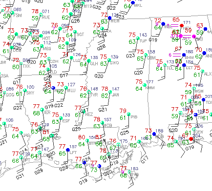
Looking at the surface map, temperatures in the areas where the sun is out have reached the 70s, and even lower 80s. The buoy about 70 miles off Dauphin Island shows a dewpoint of 67, and that humid air will continue to come in tonight.
With helicity values over 300 and CAPE as high as 1000 J/kg over west Alabama, it looks like scattered severe storms could develop as early as Tuesday afternoon, mainly west of I-65. Still, the storms will become more widespread to our west during the afternoon, and the main round of storms in Alabama should be after sunset, with the squall line not coming through BHM until after midnight. Damaging wind will be the main threat with the squall line, but tornadoes will be possible. The higher risk for tornadoes will occur with storms that form out ahead of the line tomorrow afternoon and evening.
Please keep an eye on this developing weather situation.



