


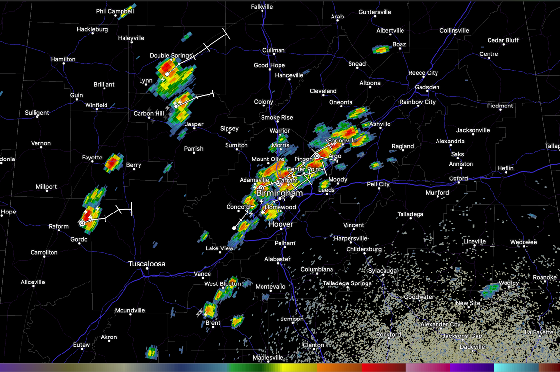
Showers and storms are developing in the unstable airmass across Alabama this afternoon.
An upper-level disturbance is passing to the north of Alabama, and increasing wind flow in the middle levels of the atmosphere may help to provide just enough shear for a few severe storms to form.
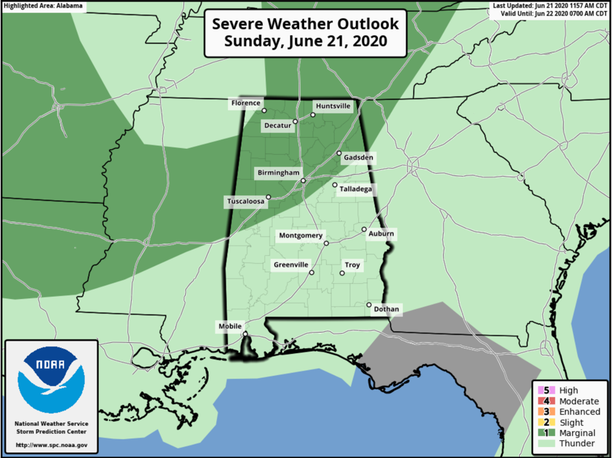
The SPC has outlooked much of the northwestern third of Alabama, generally along and northwest of I-59, in their lowest risk of severe weather (1/5). Damaging wind is the only threat.
For now, the main concentration is currently forming from St. Clair into Jefferson County. Others are over Winston and Walker Counties. And more are over Fayette, Pickens, and northwestern Tuscaloosa counties.
Additional storms will form through the afternoon. They should die out leaving a calm evening. More storms are on tap for tomorrow.
Watch out for heavy rain, dangerous lightning, and strong gusty winds. We will be monitoring in case any do manage to become severe.



