


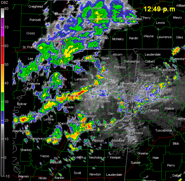
Showers and storms are increasing in coverage and intensity now in the relatively unstable air over North Mississippi and Northwest Alabama.
In addition, some are forming over East Central Alabama.
Storms are growing from Koziusko in West Central Mississippi to between Winona and Ackerman then to Starkville and Aberdeen, MS then into Lamar County, Alabama up to Moulton and Haleyville and then into southern Tennessee.
To the west of that, a short line of strong storms extends from north of Greenville to southeast of Batesville in West central Mississippi.
In East Alabama, a developing thunderstorm was between Collinsville and Fort Payne. Others were clustered between Talladega and Ashland, as well as between Rockford and Dadeville. From there, they are scattered back into Southwest Alabama.
Everything is moving east and southeast at about 20 mph.
There is a chance of showers and storms during the pre-game in Tuscaloosa this afternoon, with a good chance of a period of showers and storms during the game, including lightning and some heavy rain.



