


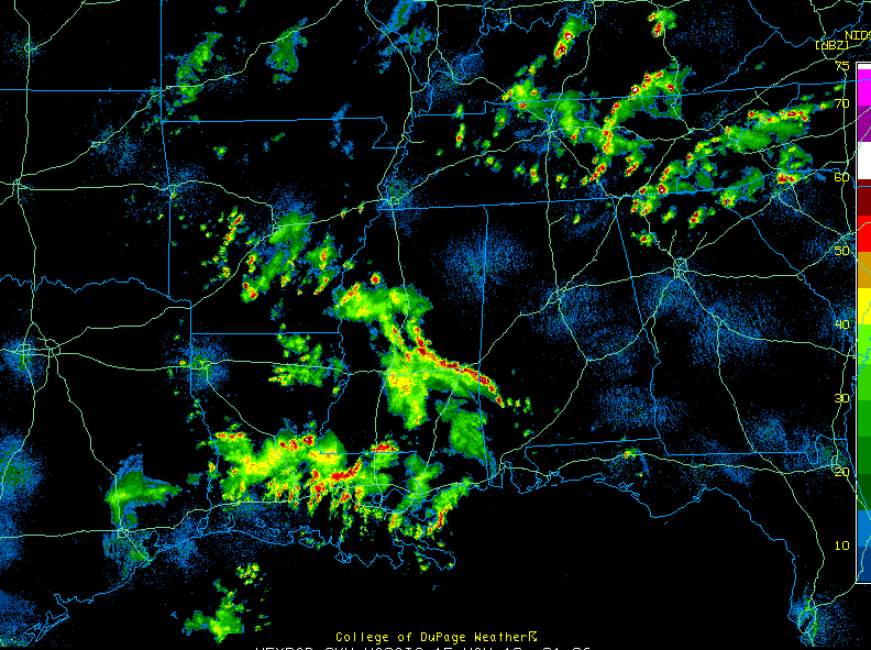
High pressure off the Southeast Coast continues to keep Alabama mainly dry this afternoon.
Showers and storms were becoming more plentiful over Northwest Georgia along a stationary front. A few isolated storms will likely form back into the Tennessee Valley of North Alabama over the next few hours. One was already over eastern Madison and western Jackson County. They lift lift northward.
Showers and storms are common over Mississippi where the high has lost its grip. A passing disturbance was triggering the storms, and a couple of severe thunderstorm warnings have been necessary.
Showers and storms extended over into Choctaw and Clarke Counties in Southwest Alabama. This activity will move north northeast across the western counties of the state through the late afternoon and into the evening hours. Areas on a line from about Linden to Tuscaloosa and to the west will have the best chances for rain and storms trough this evening.
Showers and storms will be on the increase over Northwest Alabama later tonight and will affect locations in the I-20 and 59 corridors on an increasing basis on Sunday. Rain chances will be pretty good tomorrow…about 60-70%. Could see a few strong storms tomorrow, but no significant severe weather is expected.



