


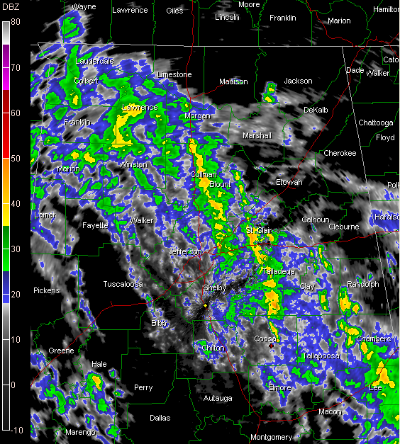
A little take off on the name of that familiar hymn seems appropriate for some folks across Alabama on this Sunday morning as a general rain is falling in a curved band wrapping around the low which is situated near the Alabama/Mississippi border around Meridian.
Overall the band is generally stationary, perhaps lifting slowly to the north and northeast. The coverage and intensity of the rainfall in increasing. This means a general soaking rain for much of North Central and East Central Alabama for the next few hours.
Rainfall rates are generally around one quarter inch per hour in the moderate rain with up to a half inch or more per hour in the heavier showers.
No thunder involved yet, although I would expect to see some eventually.
TROPICS
Earl is now a hurricane. It continues to strengthen and will affect the northern Leeward Island tonight and early Monday. Hurricane warnings and watches are in effect for parts of the Leeward Islands. The new forecast track carries it east of the North Carolina Outer Banks then menaces Cape Cod Friday.
Danielle is weakening and heading out to sea.
The disturbance over the eastern Atlantic is less organized this morning. The GFS has been consistently saying this one wouldn’t amount to anything, and it could be right. The NHC still gives it an 80% chance of becoming a topical depression in the next 48 hours.



