


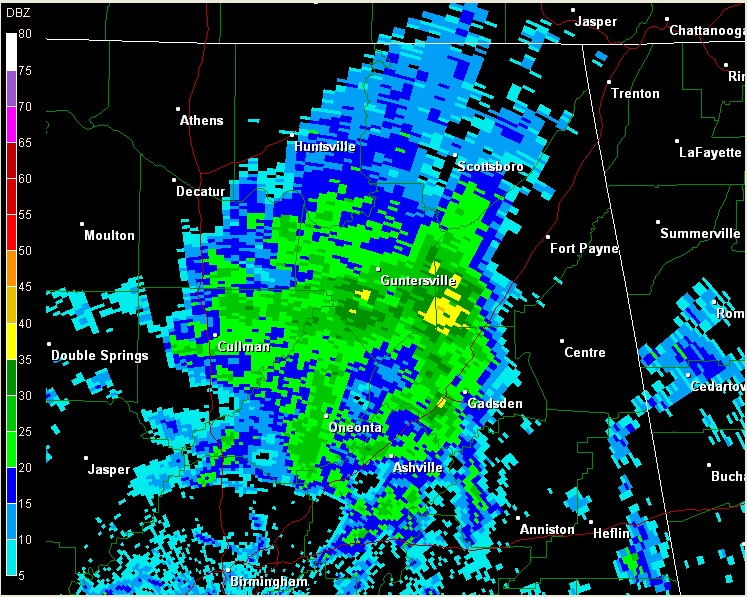
Showers pushed into West Alabama early this afternoon, and have been moving east ever since. They are associated with a fairly strong little disturbance that caused severe weather well to our west last night. We haven’t see any lightning since western Mississippi around mid-morning.
Just before 8:30 tonight, the showers covered much of Cullman, Blount, northern St. Clair, Etowah and Marshall Counties, pushing into DeKalb County. The heaviest precipitation (still moderate at best) was from south of Guntersville to between Albertville and Collinsville.
Radar precipitation estimates indicate that the rainfall has been light, averaging less than a tenth of an inch. Ron Hughes in Coker reported only .02 of an inch (he was on the southern fringe of the activity.) The rain around Birmingham has barely been enough to wet the ground. The airport has not reported measurable precip yet. Columbus MS did have 0.29 inches, and radar shows areas of southern Lamar County around Millport probably did as well.
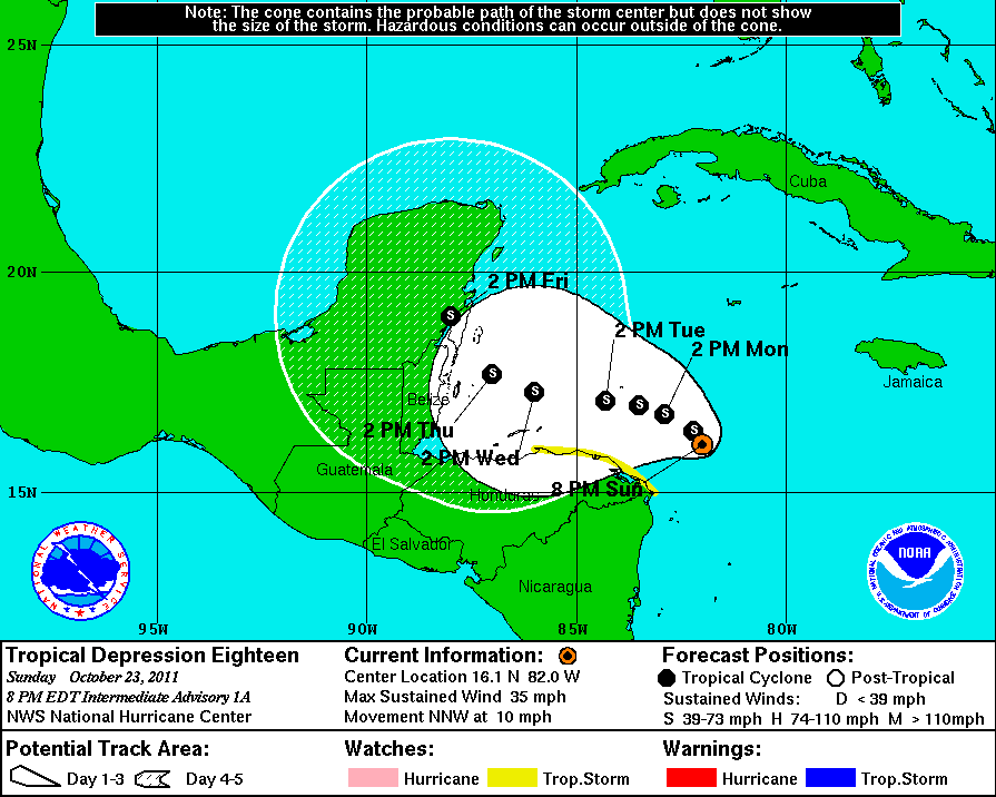
TD #18 TO BECOME TS RINA SOON
Tropical depression number 18 formed from the area of disturbed weather over the southwestern Caribbean early this evening. It is moving north northwest and is expected to turn northwest and west northwest, staying north of the coast of Honduras then making landfall on the eastern Yucatan Friday. From there, it could turn northeast and cross Cuba or pass through the Florida Straits. It could weaken over the Yucatan. It is not expected to become a hurricane.



